Langley Flat Provisional School 1927-1928

Paddock with tall trees in the centre and cattle around the trees, and a brown sign for Langley Flat Provisional School in front of them

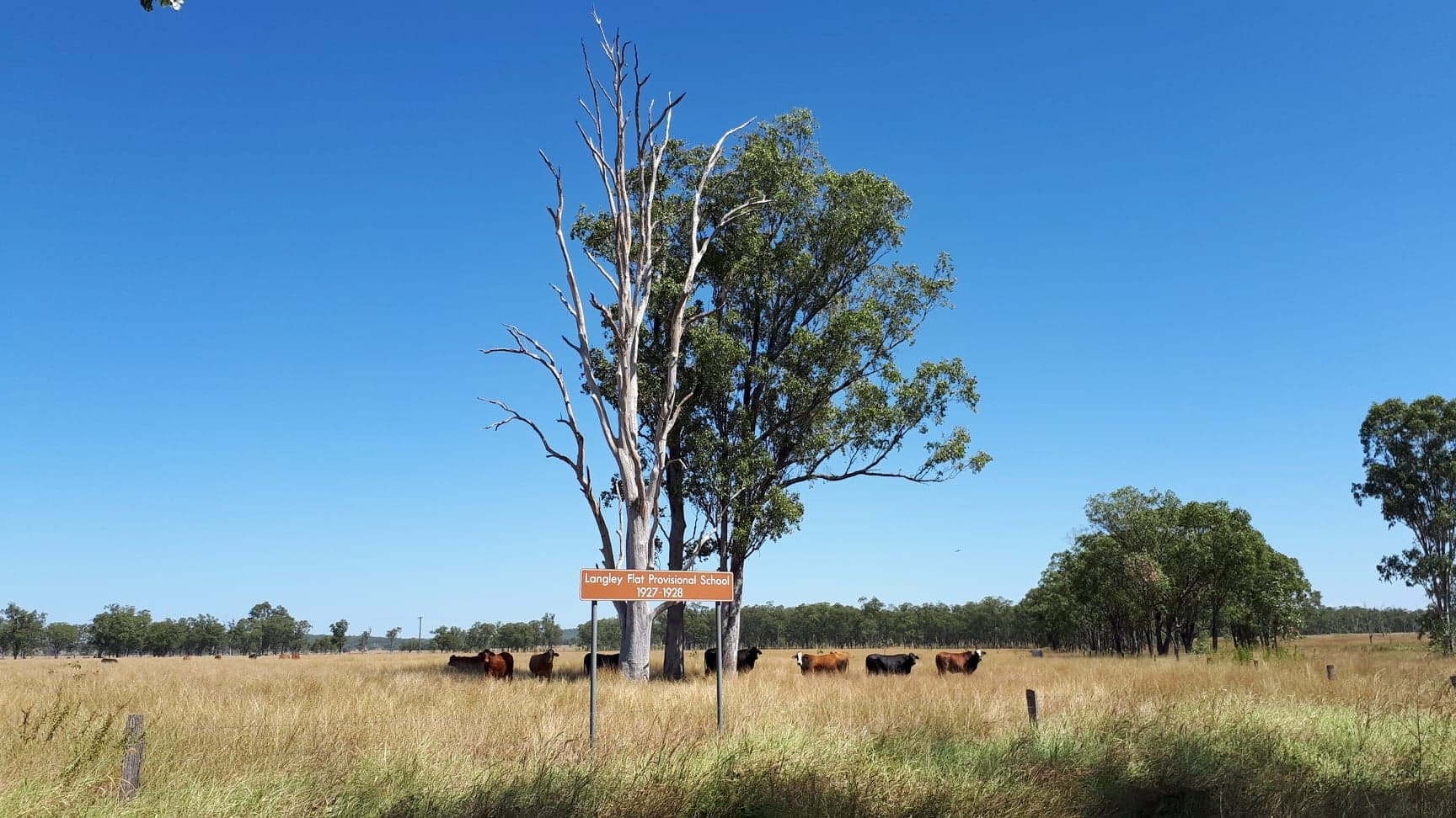
The brown sign for Langley Flat Provisional School 1927-1928 is in a field on Cooks Rd off Burnett Hwy. Langley Flat Provisional School first opened as Springfield State School in November 1911, closing 10 years later in December 1921. It opened for a short period between July and December in 1922 to support Jimbour State … Read more

Kondalilla National Park (southern access)

Kondalilla National Park is in the Blackall Range, west of the Sunshine Coast. It is nestled between Lake Baroon and Mapleton, just west of Montville. It is named after the Kondalilla Falls, an Aboriginal word meaning “rushing waters”. Kondalilla Falls  is the main attraction in the Kondalilla National Park, but there is a southern access … Read more

Lake Baroon (Northern Area)

Lake Baroon is between Maleny and Montville on the Blackall Range. The lake is created from the Baroon Pocket Dam  on the Obi Obi Creek, as a water supply for the Sunshine Coast area. This is the northern recreational area for Lake Baroon and accessed from Montville. Another recreational area is on the southern end … Read more

Baroon Pocket Dam

Baroon Pocket Dam is near Montville, built on Obi Obi Creek, and forming Lake Baroon . The ungated dam was completed in 1989 and is used for potable water supply. A plaque shows it was officially opened in July 1989. The main inflows are from Bridge Creek and Obi Obi Creek, and the dam spillway … Read more

Scenic Lookout

Gerrard’s Lookout, shown on the brown signs as Scenic Lookout, is along the Maleny-Montville Rd on the Blackall Range near Montville and looks east off the range towards the coast. A shelter has a couple of tables and seating at either end, suitable for having a break with some stunning views. A plaque near the shelter … Read more

Gardners Falls

Gardners Falls is a popular spot near Maleny along the Obi Obi Creek. The easy 800m return walk leads to a swimming hole above and below the main falls. Swinging ropes are positioned around the hole, and the rock ledges at the top of the falls provide additional launching points for the adventurous. Jumping into … Read more

Mary Cairncross Park

Mary Cairncross Park is a conservation reserve in Maleny on the Blackall Range. The reserve is a 55 hectare area of subtropical rainforest, preserving the remnants of the ecosystem once covering the southern part of the Blackall Range. The area was heavily timbered from the 1880s, in particular for the prized red cedar trees, and … Read more

McCarthys Lookout

McCarthy’s Lookout is in Maleny, on the aptly named Mountain View Rd. It looks east off the Blackall Range towards the coast and the gorgeous Glasshouse Mountains. The area was owned by Joseph McCarthy, purchased in the 1880s, and became known as McCarthy’s Farm. Namesakes from the McCarthy family still exist with McCarthy Road, McCarthy … Read more

This Side of the Black Stump

Brown sign for This Side Of The Black Stump

This Side of the Black Stump is used to convey an perceived eastern border in Australia for where civilisation is contained. To go further is to be Beyond the Black Stump , and into the remote outback of Australia. The origin of the expression, and the Black Stump  itself, is contested for a few towns. As … Read more

Beyond The Black Stump

Brown sign for Beyond The Black Stump

The Black Stump  is claimed by more than one town. Blackall in Queensland has the brown sign to show where Beyond the Black Stump begins – on the western side of the black stump. Beyond the black stump is considered to be remote or uncivilised, a marker of the limits of established settlement in pioneering … Read more