


Mount Kynoch Lookout is on the approach to Toowoomba heading south along the New England Highway. It has views looking over the valley below and to the south-east towards Brisbane and Gold Coast.
The area is named after a well-respected former councillor of the Highfields Shire Council, John Kynoch. He was a member for 30 years, elected to council in 1905.
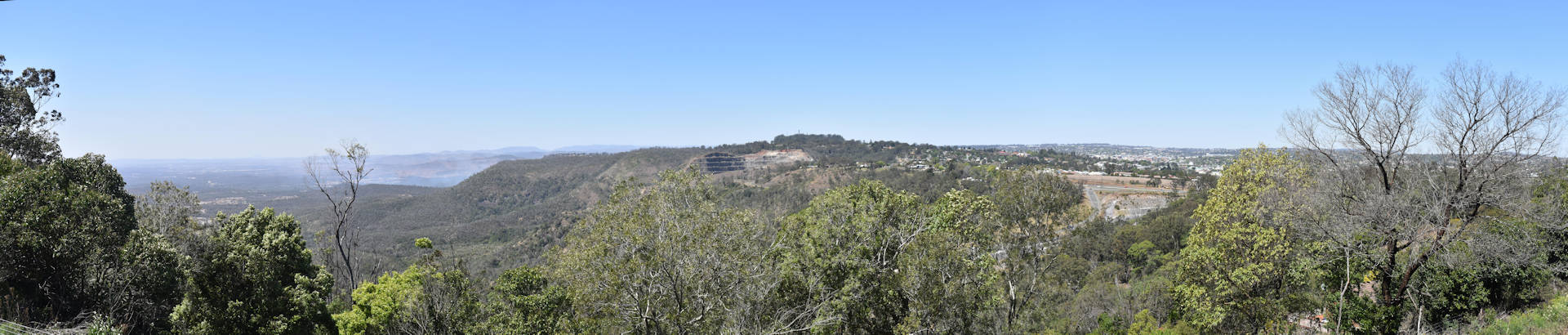
The area was originally a trigonometric station called Stoney Pinch, changing its name to Kynock in 1981. The misspelling was later corrected in 2002. Stoney Pinch is still used as the name of the quarry that can be seen from the lookout.
The Darling Downs was originally known as the upland area and the indigenous people used fire to burn the grasslands. The burning triggered the growth of new green sprouts which in turn attracted animals for hunting.
The technique earned the people the name ‘Gooneburra’ by the coastal tribes, meaning the ones who hunt with fire. This is close to the Goomburra name used in the Main Range National Park Goomburra Section ![]()
![]() .
.
The rest area at the lookout is basic with some parking spots, a sheltered picnic table and an additional one unsheltered, and a bin. It is only accessible heading south so if you are in Toowoomba you will need to go passed it and come back after finding somewhere to turn around.
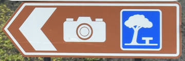
The brown sign is simple lookout symbol (a camera symbol), the name isn’t displayed on the sign.
To Get There
From the Toowoomba Visitor Information Centre, head out of the parking area and turn left onto James St, then immediately right at the lights onto Kitchener St. Follow Kitchener St for 1.1km to a roundabout, heading left, then immediately right onto Hume St (following the green sign To North), getting into the left lane. Veer left towards Crows Nest then after 500m, turn right onto Ruthven St. Follow Ruthven St which becomes the New England Hwy for 6.3km to a set of lights at Murphys Creek Rd. Do a U-turn and head back 750m, exiting into the rest area and lookout on the left.

