


This brown sign destination for the Condamine River is at a park next to the river and a large park area in Warwick.
This was the second sign for the river we came across on the same day, the other being in Killarney at the Ellen Backhouse Park.
The start of Condamine River is in the Main Range National Park at The Head, near Carrs Lookout along the Falls Drive.
The Condamine River runs for 657 kilometres, passing first through Killarney, then Warwick and Chinchilla. At Surat, it heads south-west becoming the Balonne River. It becomes the Culgoa River before joining the Darling River near Bourke.
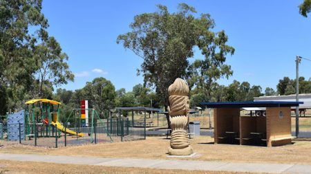
The immediate park at the brown sign is a decent rest stop with flushing toilets, bins, free gas BBQs and a fenced-in playground for the kids.
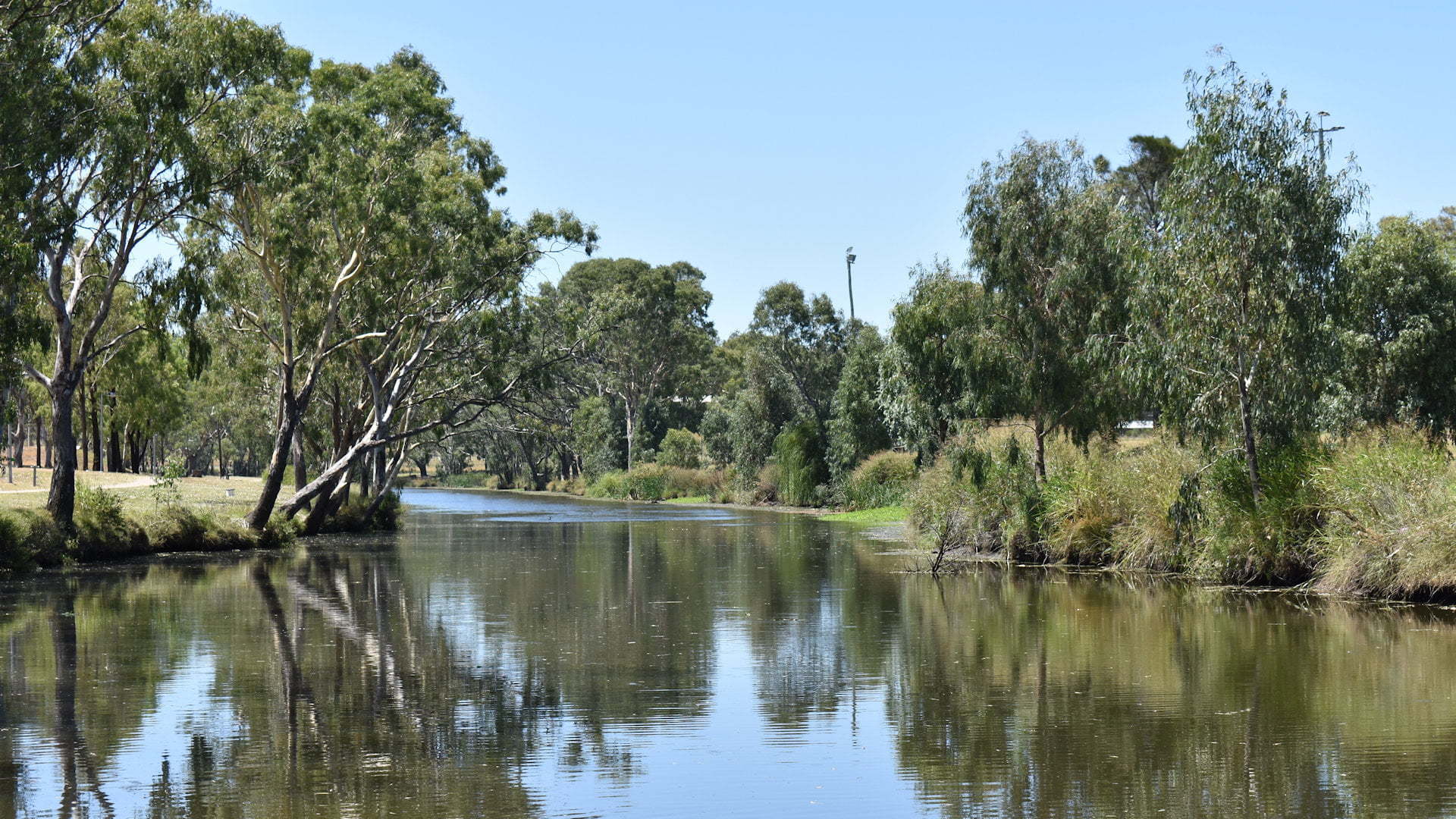
Walk down to the river to reach Federation Park, a grassy parkland that runs for a long way along the Condamine River, particularly if you go under the bridge into Queens Park.
According to Aboriginal legend, Tiddalik the frog swallowed all the water and caused a drought. The animals tried in vain to make him release the water until Nabunum the eel danced a comical dance. Tiddalik burst out laughing and the water gushed from his mouth and flowed away to replenish the lakes the swamps and the rivers.
There are a couple of sculptures of a bloated frog, representing Tiddalik from the Aboriginal legend.
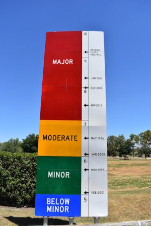
A flood sign shows the various flood heights that have occurred in Warwick along the Condamine River.
The largest flood was in 1976, at more than 9 metres. There were three other major floods in 2010, 2011, and 2013, all over 7 metres.
Minor to moderate floods happened in 1996, 1999, 2001, and 2006. Tiddalik has had quite a few laughs over the years.
Another sculpture, called Breeding Pair of Murray Cod, is dedicated to the Murray Cod with a plaque for Warwick Murray Cod Rehabilitation Reach. It says, Habitat structures have been returned to the Condamine River to improve the breeding and population of the iconic and threatened Murray Cod.
To get there:
Coming into Warwick from the north, continue along Cunningham Hwy for about 1.5km to the bridge over the Condamine River. The entrance to the park is another 200m from the bridge, the first left after crossing the bridge.
Coming into Warwick from the south, follow the Cunningham Hwy all the way into town to the traffic lights, about 2.5kms from entering into Warwick. Turn right following the signs towards Brisbane, then after 1.4km turn left at the lights. You can’t turn right into the park area, so continue for 1.7km crossing over the Condamine River and take the first left into Jackie Howe Dr. Do a u-turn to come back out and turn right and cross the Condamine River again. The entrance to the park is another 200m from the bridge, the first left after crossing the bridge.
Coming into Warwick from the west, follow the Cunningham Hwy all the way into town to the traffic lights, about 1.3kms from entering into Warwick 60 zone. Continue straight ahead following the signs towards Brisbane, then after 1.4km turn left at the lights. You can’t turn right into the park area, so continue for 1.7km crossing over the Condamine River and take the first left into Jackie Howe Dr. Do a u-turn to come back out and turn right and cross the Condamine River again. The entrance to the park is another 200m from the bridge, the first left after crossing the bridge.
Cost: Free
Hours: Anytime
Toilets: Yes
Bins: Yes
Tables: Yes
Seating: Yes
Water: Yes, sink at toilets
Food: No
Wheelchair accessible: Yes
Pets: Yes, on leash
BBQ: Yes
Playground: Yes

