Fingal Head is at the northern top of New South Wales and offers several interests at the one location, from beautiful beach, coastal scrub walk, views of an off-shore island, and a fairly unique coastal rock formation.
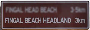
Before we knew there was a brown sign, the rock formation of the Fingal Heads Causeway is what drew us to it. It is from the causeway the headland received its name from, when landed by John Oxley in the 1820s.
It is thought Fingal Head is what Point Danger was named as but was later confused to be the headland further north at the mouth of the Tweed River.
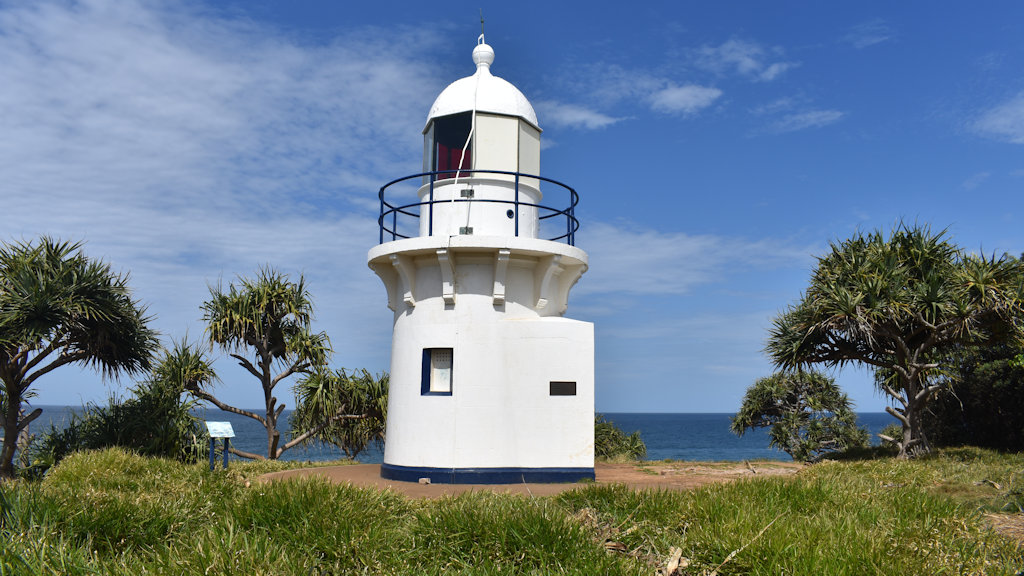
The Fingal Causeway brought us to the headland but we found there are more things adding further reason to come here. The signage straightaway shows Fingal Head Lighthouse. There is signage with a notice of swimming between the flags, however, you are better off to go to Fingal Head Beach ![]() as it is easier to get to the same patrolled beach.
as it is easier to get to the same patrolled beach.
The track leads from a small parking area towards the headland with a couple of side-tracks on the way. Towards the left leads to the patrolled beach, to the right takes you to a beautiful beach south of the headland. Head straight and you arrive at some wooden ramps that take you to the top of the headland near the lighthouse.
Fingal Head Lighthouse

Fingal Head Lighthouse was built in 1878 and completed in 1879, the oldest public building in the Tweed region. It replaced an earlier provisional lighthouse build in 1872.
The tower was built using Sydney sandstone with an enclosed porch and an oil room. It originally had an attached lighthouse keeper’s duty room but it was later demolished.
The lighthouse was first fuelled by kerosene and had to be lit 10 minutes before sundown. The lighthouse keeper had to tend the lighthouse until morning when it was extinguished.
In 1923, the kerosene fuel was replaced with an automatic acetylene fuelled system. The need for an attending lighthouse keeper was no longer needed with the automatic system.
Two further upgrades converted the lighthouse to electricity in 1970 and updated to cover a greater range in 1980.
The lighthouse was designed by James Barnet, the Colonial Architect of NSW between 1862 to 1890. The design was used with four other lighthouses located in Ballina, Yamba, Tacking Point, and Crowdy Head.
Fingal Heads Causeway

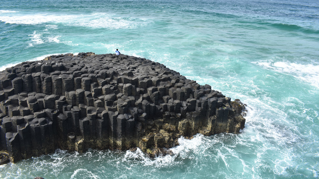
The hexagonal basalt columns were formed from slowly cooling lava from the Mt Warning volcano. The columnar-jointed basalt rock formation of Fingal Heads Causeway is similar to the Giant’s Causeway in Northern Ireland ![]() , near Bushmills, and Fingal’s Cave on the island of Staffa in Scotland
, near Bushmills, and Fingal’s Cave on the island of Staffa in Scotland ![]() . The mythological giant Finn (in Ireland) or Fingal (in Scotland) tried to build a causeway over the ocean between the causeway and the cave.
. The mythological giant Finn (in Ireland) or Fingal (in Scotland) tried to build a causeway over the ocean between the causeway and the cave.
The Aboriginal name for Fingal Head is Booninybah, meaning home of the Echidna. Aboriginal stories tell of the spirit of the giant echidna, embodied in the rock formation on the north-eastern point of the headland. The columns are the spines of the echidna.
You can get across to the causeway clambering over the rocks during the lower part of the tides but it can become cut off during high tide. There were fishermen on the rocky outcrop while we were there but I couldn’t say how well they were doing.
Cook Island sits in the background further out to sea, around 600 metres out. Cook Island is named after Captain James Cook when he passed it on 16th May, 1770. On investigating the island, they found turtles and called it Turtle Island. It was over 50 years later it was given its present name by Captain Rous in 1828.
Dreamtime Beach

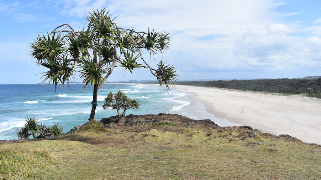
The beach to the south of Fingal Head is called Dreamtime Beach, which extends continuously to Kingscliff Beach. Dreamtime Beach was the most rewarding surprise we received. Perhaps we were influenced by it being unexpected but we found it to be one of the most beautiful we have been to.
It is important to note that this is a dangerous beach. It is unpatrolled and the unobstructed ocean surf can produce notoriously dangerous rips and undercurrents. If you do not know how to look for and deal with rips, then this is not a good place for you to swim.
Aside from the danger associated with Dreamtime Beach, it is stunning. It was named the third-best Australian beach ![]() in 2018 by 101BestBeaches blog website.
in 2018 by 101BestBeaches blog website.
The beach sand comes right up to the rocky headland beside it with a few rocks under the water close to it. There is a cutting in the rock that encloses overhead creating a narrow cave the cuts through from the beach side to the ocean side.
The headland above the beach has a nice grassy section that would be wonderful vista during a picnic lunch. The views are unobstructed save for one tree that somehow makes it better still. The cliffs are fairly sudden though so care is needed with children.
You don’t have to swim but the temptation is certainly there. Being September, the water was still cooler from the winter but the weather was warm enough to have a swim. There were a few people on the beach but it wasn’t busy by any measure. It could be much busier with warmer weather as the summer months approach.


