


Boundary Falls is in the Gibraltar Range National Park in the New England North West region of northern NSW. The park requires a vehicle day pass and separate camping fees if you stay overnight.
The area is separated into two sections, the day-use picnic area and the camping area. The two areas are a short distance from each other with a path connecting the two together.
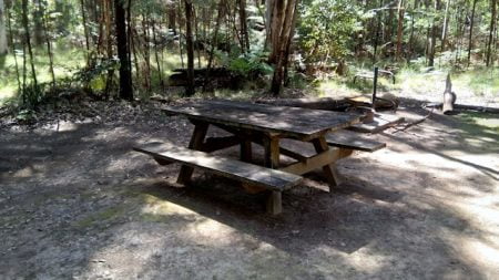
The picnic area has picnic tables and free gas BBQs for use, handy for a cooked lunch while stopped at Boundary Falls. The camping area doesn’t have gas BBQs but the campsites have swing-away BBQ plates over the fireplaces, as well as a hanging post to hang a camp oven over the fire.
Walking tracks lead from the picnic area to Boundary Falls and the Lyrebird Falls, the first being the namesake of the picnic area and campground.
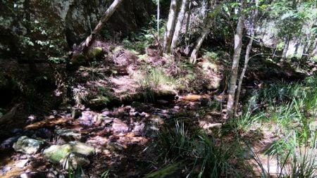
Boundary Falls is the shortest walk, only 200 metres from the picnic area to the small water pool at the base of the falls, 400 metres return. Shortest isn’t always the easiest. The walk isn’t difficult but it has quite a few stairs to get the cardio system working hard. A rest area is part way down the stairs where you can have a rest but it doesn’t have any seat to use or any view to look at while you take a break.
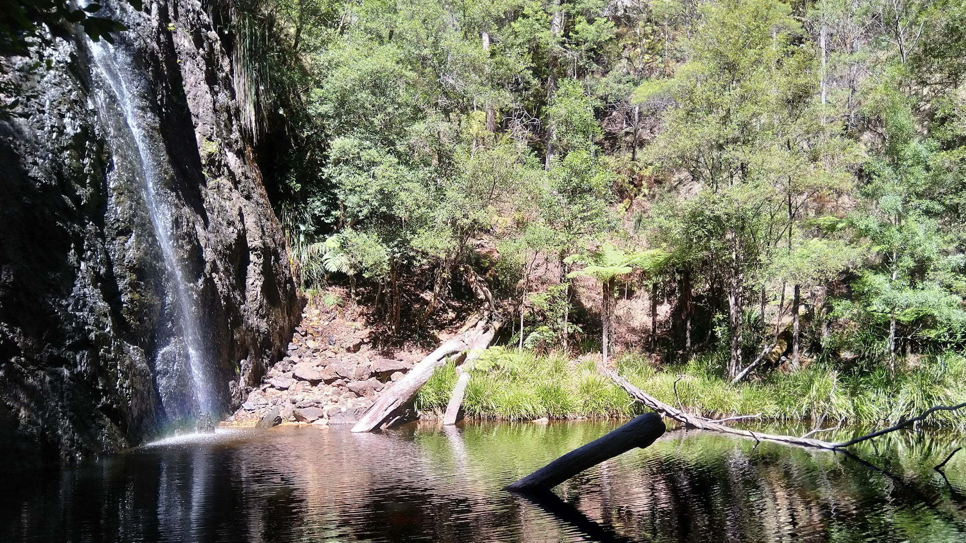
The bottom of the stairs comes out on Boundary Creek with crystal clear water flowing gently passed. The falls are a short distance upstream with viewing spots from directly opposite the falls and from the base of the cliff by crossing over Boundary Creek just before the waterhole.
The waterhole is at the base of the waterfall and looks so inviting for a swim. The sun was caressing the edge of the water and down to the bottom of the falls, creating a mini rainbow where it splashed into the waterhole. With the high altitude, the water is freezing cold, wonderful during the hotter summer months for a crisp swim.
Boundary Creek was once the border of two properties, which is how it possibly got its name. The creek is also a border of differing vegetation, one side is a dry forest, the other a wet forest. Boundary Creek runs along a fault line called the Demon Fault. The two sides have moved 20 kilometres in opposite directions resulting in different soils to each other, supporting the different types of forest. The valley along the Demon Fault can be seen at Raspberry Lookout ![]()
![]() , not far from Boundary Falls.
, not far from Boundary Falls.
Lyrebird Falls is further downstream starting separately from the Boundary Falls walk, with a view over Lyrebird Falls and Boundary Creek. The 2km grade 4 return walk takes about 60 to 90 minutes. Lyrebirds inhabit the area the track passes through, as the name of the falls may suggest.
If you want a more adventurous and challenging walk, the Gibraltar-Washpool World Heritage Walk is a 45km grade 4 loop taking 3 to 5 days, with a number of optional side walks along the way that can increase the distance to over 80km if they are all done. Gibraltar-Washpool World Heritage Walk can be accessed from the campground.
Duffer Creek and Grassy Creek are longer walks possible to do in a single day. Duffer Creek is 7.4km return taking about 3 hours, heading north on the Gibraltar-Washpool World Heritage Walk from near the campground. Duffer Creek is a short detour off the heritage walk down to the falls.
Grassy Creek is 19 kilometres return taking 7 hours, so it will need more preparation and planning, plenty of water and food, and prepared for delays that could leave you returning in the dark. The Duffer Creek detour can be done the same time, however, consider doing this on the way back when you know if you have sufficient time to do the extra distance.
The national park used to be a state forest supporting a timber industry for over 20 years. Around the campsites, you can find old pieces of the milling equipment left behind from Wades Sawmill. Wades Sawmill was built in the 1930s to process the hardwood trees.
The English steam engine still at the site once powered the sawmill, before it was replaced by a diesel engine around 1956. The biggest hardwood trees are gone and so is the sawmill, with a few items left to remind us of it and the several huts supporting the workers and their families.
The entry to Boundary Falls has changed. There are web pages that lead you to the original entrance which has now been blocked. The new entry is a
To Get There

From Glen Innes, from the New England Hwy, turn into Gwydir Hwy towards Grafton. Follow Gwydir Hwy for 60km. The entrance to Boundary Falls is on the left with a brown sign 400m before and another opposite the entrance track. Note that the original entrance shown on many maps is further west but is now blocked and closed off. From the entrance, it is about 1km on a dirt road to the picnic area and the campground a little further on.
From Grafton, head west towards Glen Innes on Gwydir Hwy. Follow Gwydir Hwy for 94km. The entrance to Boundary Falls is on the right with a brown sign 400m before and another opposite the entrance track. From the entrance, it is about 1km on a dirt road to the picnic area and the campground a little further on.
From Raspberry Lookout ![]()
![]() , head back out to Gwydir Hwy and turn left. The entrance to Boundary Falls is 600m on the right.
, head back out to Gwydir Hwy and turn left. The entrance to Boundary Falls is 600m on the right.
From Mulligans Hut, head back out to Gwydir Hwy and turn left. The entrance to Boundary Falls is 8.5km on the right.

