
Mapleton Falls National Park is a small section just south of the larger Mapleton National Park, only 4kms from the township of Mapleton.
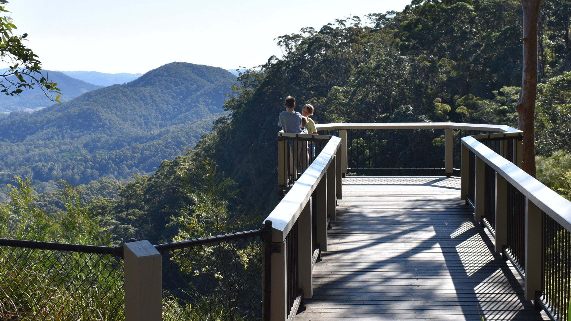
The falls are less than 50m the parking area, making it one of the most easily accessible waterfalls we’ve been too. Unfortunately, the view of the falls themselves is not the best. The viewing platform extends you out further than you could be without it, but you are still unable to see most of the falls.
Part of the waterfall can be seen where it first starts to descend. The main drop of the falls is hidden with Pencil Creek seen re-emerging into view down below after the falls.
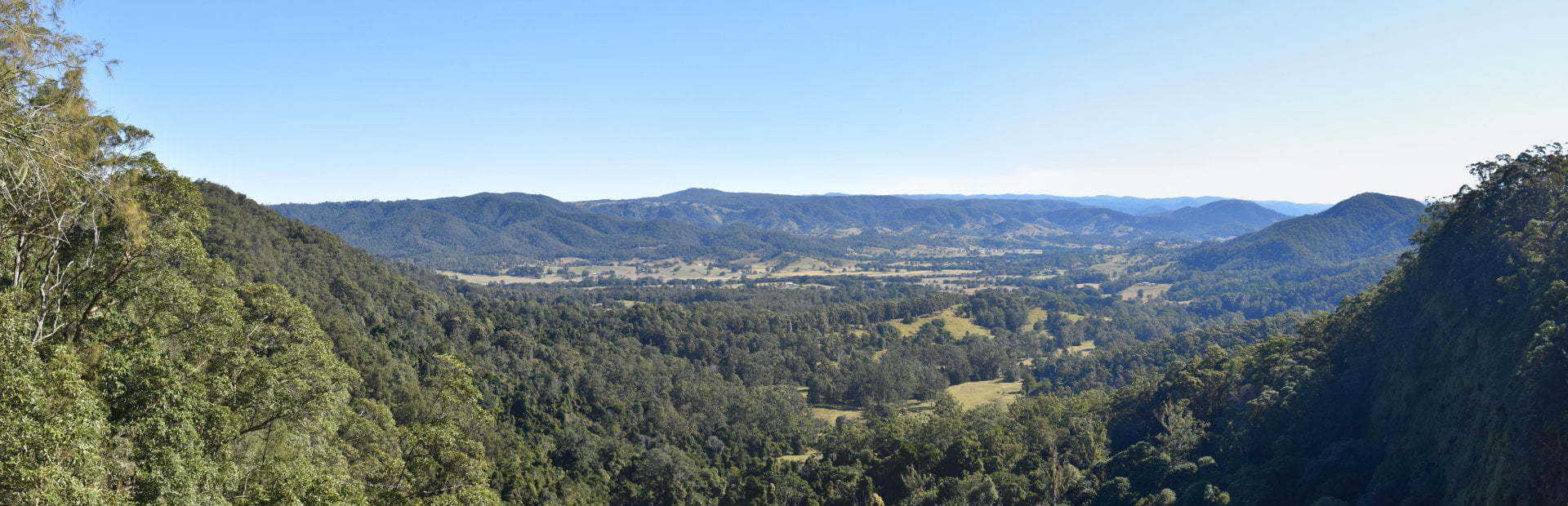
That being said, the views out to the west are beautiful and worth seeing in their own right, looking across the valley of Obi Obi and Kidaman Creek.
Picnic Area
From the parking area and lookout over Mapleton Falls, a path leads down to the creek about 40m from the parking area, and then up to the picnic area. The picnic area is quite modest with a couple of picnic tables and some grass areas. There is a shelter with two picnic tables and seating tucked in one spot. There are no toilets but there are toilets back at the parking area which isn’t too far away.
Woompoo Circuit
A walking track leads into the heart of the Mapleton Falls National Park, a 1.2km return circuit from the picnic area, which covers the majority of the park. The name of the circuit, Woompoo after the wompoo fruit-dove, had my boys in giggles for days and weeks afterwards.
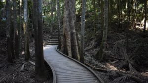
It starts off with a caution of a slippery track when wet, something we didn’t need to be concerned with in the long dry weather we have had. In low sections, there are boardwalks keeping you out of spots that could be wet and muddy.
 There are a few stairs on the circuit, mostly on the first 100m section to where the circuit part starts, otherwise it is an easy walk. The steep path from the parking area to the picnic area is probably the worst part.
The circuit leads through the rainforest and eucalypt forest with the odd information sign along the way. Part way around the circuit is Peregrine Lookout. The National Parks website says it provides good views of Mapleton Falls but we didn’t see the falls from Peregrin Lookout. The rock cliffs on the other side of Pencil Creek was the main feature, which looked nice in the mid-afternoon sun.
Walking the circuit clockwise follows a section of the Sunshine Coast Hinterland Great Walk, a 58km walk starting at the southern end of Kondalilla National Park ![]()
![]() .
.
Overall, Mapleton Falls National Park is worthwhile visiting. The walk is easy and enjoyable, the views are beautiful, and the picnic area is a nice spot with plenty of shade. The name of the national park gives an expectation of the falls being the main feature which led to some disappointment. If it was called Mapleton National Park then the glimpses of the falls would be a bonus rather than a letdown. My boys will always remember Woompoo.
To get there:
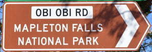 From Steve Irwin Way in Landsborough, turn into Railway St, and after 300m turn left into Maleny St and cross over the railway line. In 800m, continue straight ahead, through the roundabout into Landsborough Maleny Rd. The climb is steep for a few kilometres, and after 9.7km, turn right into Maleny-Montville Rd. Continue for another 10.1km, which becomes Balmoral Rd then Main street. Continue through the town of Montville, becoming Montville Mapleton Rd, for another 9.2km and turn left into Obi Obi Rd at Mapleton with the brown sign for Mapleton Falls National Park. Follow Obi Obi Rd for 2.9km and turn right into Mapleton Falls Rd with another brown sign. Follow Mapleton Falls Rd for 850m to reach the parking area for Mapleton Falls National Park.
From the Bruce Hwy, take the exit for Mapleton (Exit 208) and follow the signs towards Nambour and Mapleton on the Nambour-Bli Bli Rd. Continue for 1km and cross straight ahead at the lights into National Park Rd. Follow for 12.2km becoming Netherton St then Nambour-Mapleton Rd. Turn right into Obi Obi Rd at Mapleton with the brown sign for Mapleton Falls National Park. Follow Obi Obi Rd for 2.9km and turn right into Mapleton Falls Rd with another brown sign. Follow Mapleton Falls Rd for 850m to reach the parking area for Mapleton Falls National Park.
From Dulong Lookout and Kanyana Park ![]()
![]() , head north to Nambour-Mapleton Rd and turn Left. Continue on Nambour-Mapleton Rd for 5.3km and turn right into Obi Obi Rd at Mapleton with the brown sign for Mapleton Falls National Park. Follow Obi Obi Rd for 2.9km and turn right into Mapleton Falls Rd with another brown sign. Follow Mapleton Falls Rd for 850m to reach the parking area for Mapleton Falls National Park.
, head north to Nambour-Mapleton Rd and turn Left. Continue on Nambour-Mapleton Rd for 5.3km and turn right into Obi Obi Rd at Mapleton with the brown sign for Mapleton Falls National Park. Follow Obi Obi Rd for 2.9km and turn right into Mapleton Falls Rd with another brown sign. Follow Mapleton Falls Rd for 850m to reach the parking area for Mapleton Falls National Park.
Cost: Free
Hours: Anytime
Toilets: Yes
Bins: No
Tables: Yes
Seating: Yes
Water: No
Food: No
Wheelchair accessible: Yes, for the lookout platform and toilets. Note that the parking area is steeply sloped for most of the parking spots. Once near the toilets, the viewing platform is flat and the toilets are wheelchair accessible. The path to the picnic area is steep so assistance will be required.
Pets: No
BBQ: No
Playground: No

