


Western Trailhead is the western end of Wyaralong Dam ![]()
![]() at the Lilybrook Recreation Area and the western end of the
at the Lilybrook Recreation Area and the western end of the
25km Shoreline Trail, operated by SEQ Water.
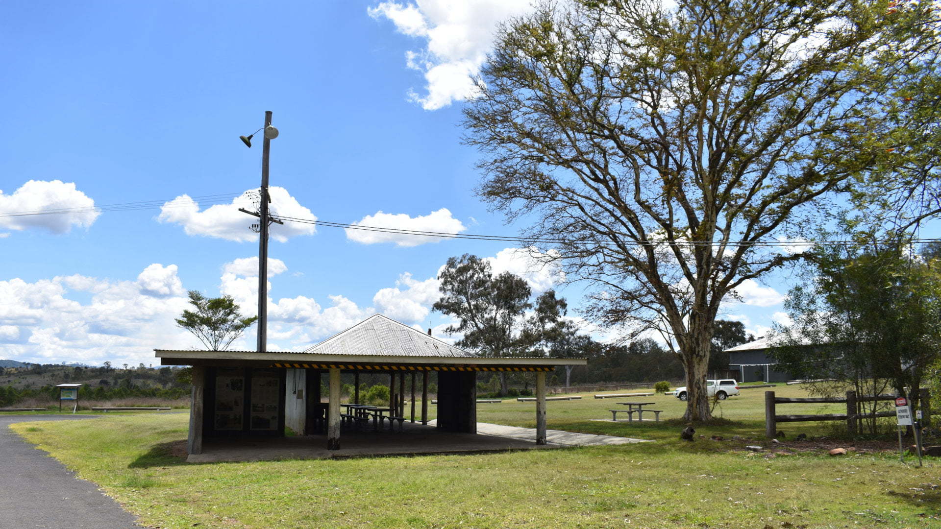
Lilybrook Recreation Area is named after the Lilybrook Homestead located there, built in the 1900s. Lilybrook farm occupied 18 hectares, other buildings included a work shed, machinery and vehicle sheds, and hay shed among others.
The work
A toilet and shower block is
Tiviot Book, originating from up the ranges and flowing over Teviot Falls ![]()
![]() , is the main feed into Wyaralong Dam and flows along Lilybrook Recreation Area. A picnic table near the brook gives a different scenic view beside the water.
, is the main feed into Wyaralong Dam and flows along Lilybrook Recreation Area. A picnic table near the brook gives a different scenic view beside the water.
Lilybrook Recreation Area caters for horse enthusiasts with holding paddocks, watering areas, and loading ramps.
Camping is not permitted at Lilybrook Recreation Area, which seemed odd as it is well set up to support camping. Camping is available for group events if pre-arranged by emailing SEQ Water recreation@seqwater.com.au ![]()
![]() .
.
The trails at the Western Trailhead are multi-use, for horse-riding, mountain biking, and hiking. The main walk is the Shoreline Trail, a 25km walk starting at Lilybrook Recreation Area and following along the northern side of Lake Wyaralong to the Eastern Trail Access near the Meebun Day Use Area of Wyaralong Dam ![]()
![]() .
.
The only camping available (other than for events) is at the Ngumbi Remote Camping Area (also known as Mt Joyce Base Camp). The camping area is along the Shoreline Trail and can only be reached by foot, mountain bike, horse, or canoe from the canoe access point on the lake.
An alternate Ridgeline Trail from Shoreline Trail heads to the summit of Mt Joyce. The eastern part of the Ridgeline Trail is walking only. Horse riders and mountain bike riders can go on the western part of the Ridgeline Trail but will need to head back the same way once the walking only section is reached.
There are shorter trails closer to Lilybrook. Lilybrook Break, Waters Link Break, Fig Tree Break, and Crows Ash Break are various trails that lead to Shoreline Trail, and in the other direction is Goan Break, Mununjali Circuit, and Sandy Creek Circuit.
While the walks are shorter, they are can be long walks with most requiring others to get to them. For example, Sandy Creek Circuit is 5.8km, but you need to come in and return through Goan Break adding 2.4km each way, and walk part of Mununjali Circuit, so the walk is nearly double the 5.8km.
Paddle the length of Lake Wyaralong with canoe access from Lilybrook Recreation Park and at the eastern end at
To get there:

From Beaudesert, from the main intersection in town, head southwest along Mount Lindesay Hwy. After 450m, turn right into Bromelton St with the brown sign for Wyaralong Dam. Follow Bromelton Rd, which becomes Beaudesert Boonah Rd, for 28.9km and turn right into a road with a turning lane and a brown sign for Western Trailhead about 400m beforehand. Follow the road for about 550m to the entrance of Lilybrook Recreation Area and the Western Trail Access.
From Boonah township, head north to the roundabout and turn right (first exit) into Ipswich Boonah Rd towards Beaudesert. Follow Ipswich Boonah Rd for 6.8km and turn right onto Beaudesert Boonah Rd. Follow Beaudesert Boonah Rd for 2.7km and turn left into a road with a brown sign for Western Trailhead about 100m beforehand. Follow the road for about 550m to the entrance of Lilybrook Recreation Area and the Western Trail Access.
From Peak Crossing, head south along Ipswich Boonah Rd. Follow Ipswich Boonah Rd for 20.2km and turn left onto Beaudesert Boonah Rd. Follow Beaudesert Boonah Rd for 2.7km and turn left into a road with a brown sign for Western Trailhead about 100m beforehand. Follow the road for about 550m to the entrance of Lilybrook Recreation Area and the Western Trail Access.
Cost: Free
Hours: Sep-Apr 5.30am-6.30pm, May-Aug 6am-5.30pm
Toilets: Yes
Bins: No
Tables: Yes
Seating: Yes
Water: Yes
Food: No
Wheelchair accessible: Yes, with assistance
Pets: No, except horses
BBQ: No
Playground: No

