


Yuraygir National Park is between Yamba and Corindi (north of Coffs Harbour), it is the largest coastal National Park in New South Wales. It was created in 1980 by combining the Angourie National Park and Red Rock National Park.
With 65km of coastline along Yuraygir National Park, there are multiple points to access the park and they are not all accessible to each other. This brown sign destination is for the northern section of Yuraygir National Park at Angourie, accessed via Yamba.
Other access points for Yuraygir National Park are towards Brooms Head and further south to areas around Ilaroo and Boorkoom Campground.
Around Angourie there are spots for scenic locations and walking trails. There is no camping at the northern parts of Yuraygir National Park.
Angourie Picnic Area
Angourie Picnic Area is a very scenic spot at the top of the coastal part of Yuraygir National Park. The picnic area has picnic tables, long-drop toilets, and is wheelchair friendly around the picnic area with some assistance possibly needed for some.
The walk from the parking area is fairly easy, however, the path becomes soft sand before reaching the beach.
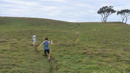
The top end of the beach is calm, protected by Angourie Point. A rocky outcrop adorned with only a few trees and a thick, soft grass over rolling hills. The grass has narrow paths barely the width of your foot across the hills. Running up the hills, one of the boys exclaimed it was like being in Scotland and it did have that feel to it.
From the grass hills of Angourie Point, you can look north towards Yamba and immediately beside it the Angourie Surf Reserve ![]()
![]() where you are almost guaranteed to see surfers trying to catch a wave.
where you are almost guaranteed to see surfers trying to catch a wave.
With access to the beach, you could start a walk along the Angourie Walk from Angourie Picnic Area, with a track just after Mara Creek comes out to the beach.
Mara Creek Picnic Area
Mara Creek Picnic Area is the second main area to go to at the Angourie part of Yuraygir National Park. Mara Creek has a picnic table, however, there are no toilets and is not wheelchair friendly.
Mara Creek has a walking trail leading at the southern end of it. The trail leads down to Mara Creek itself with a bridge over the still water in the creek, darkly coloured from the tannins in the leaves that fall into it.
After crossing Mara Creek, the trail splits with a short walk to the beach and the other way the Angourie Walk. Angourie Walk heads south for about 4km to Shelley Headland and makes up the northern part of the Yuraygir Coastal Walk leading to Brooms Head ![]()
![]() .
.
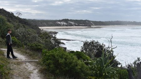
Angourie Walk takes you through a variety of scenery, from the coastland heath through to rocky coast with the ocean bashing against them. There are a number of points that continues to reward you along the way.
We went as far as Shelley Headland, continuing to Brooms Head is by walking along Shelley Beach to the southern end to return to a walking trail along the coast.
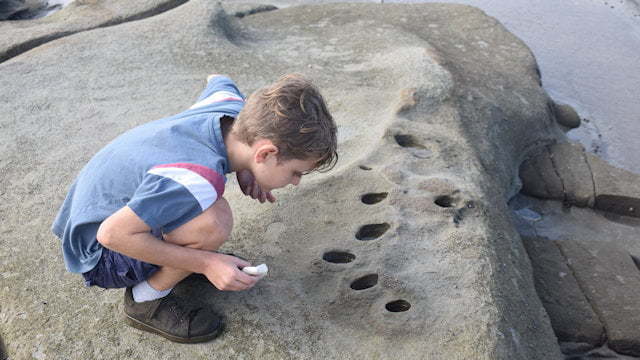
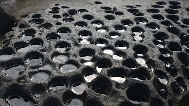
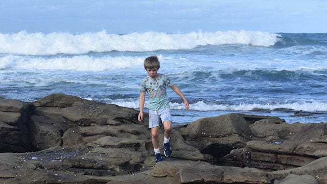
Shelley Headland had the boys enthralled, running over the rocks and investigating the rock pools filled during the high tides, one of the boys found a natural sponge. We happened to time it well to be able to walk around the rocky headland away from the crashing waves.
To Get There
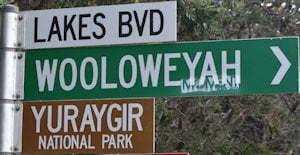
From the Pacific Hwy, follow the signs to Yamba. On entering Yamba, continue straight ahead along Yamba Rd for about 3.2km to Angourie Rd at a roundabout. Turn right into Angourie Rd at the roundabout, follow for 3.9km and turn right into Lakes Blvd with the small brown sign for Yuraygir National Park. Follow Lakes Blvd for 400m and turn left into Mara Creek Rd. If you don’t have a vehicle pass, you will need to purchase one before entering Yuraygir National Park.
