Moreton Bay stretches over 65 kilometres, reaching north of Brisbane and southern extremities of Brisbane area. The bay is enclosed by three of the four largest sand islands in the world, Moreton Island, North Stradbroke Island, and Bribie Island. On the mainland, there are two tourist drives showcasing the shorelines of Moreton Bay, one on each side of the Brisbane River.
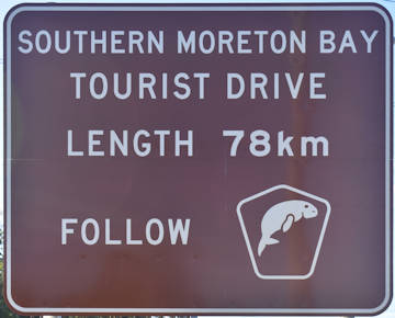
Southern Moreton Bay Tourist Drive is a 78-kilometre drive, starting on Wynnum Road just off the Gateway Motorway. It heads to Moreton Bay at Wynnum and follows the shoreline down to Redland Bay, coming in and out from the shoreline through Manly, Wellington Point, Cleveland, Victoria Point, Redland Bay. It then heads back to the Pacific Highway through Mount Cotton and Cornubia.
From Wynnum To Redland Bay
Southern Moreton Bay Tourist Drive starts on Wynnum Road shortly after the exit from the Gateway motorway
Start of Tourist Drive
The start of the drive is found along Wynnum Road, immediately west from the Gateway Motorway. The motorway has a brown sign for the tourist drive approaching the exit needed to start it from. If heading south on the motorway, take exit 100 (Wynnum Rd) and turn left at the lights. If heading north, take exit 100 (Wynnum Rd) and turn right at the lights.
Keep to the left lane along Wynnum Road to veer left 1 kilometre from the start.
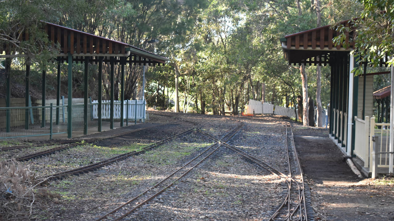
Bayside Heritage Train Park
Not quite reaching Moreton Bay yet, the Bayside Heritage Train Park is 2.4 kilometres after veering (3.4km from the start). The entrance is on the left at a set of lights at Network Drive. In addition to train rides, the park has a BMX club and remote control car track.
Train Park
The train rides operate on the 1st and 3rd Sundays of every month from 10am to 4pm. It is run by the members of the Brisbane Bayside Steam Railway Society ![]()
![]() . We were not there on a Sunday so of course the trains were not running. An excuse to come back another day.
. We were not there on a Sunday so of course the trains were not running. An excuse to come back another day.
Tickets are needed to ride the trains with funds used to support the club and maintain the railway. Kids and adults alike are able to ride and for 10 or more they can do birthday parties.
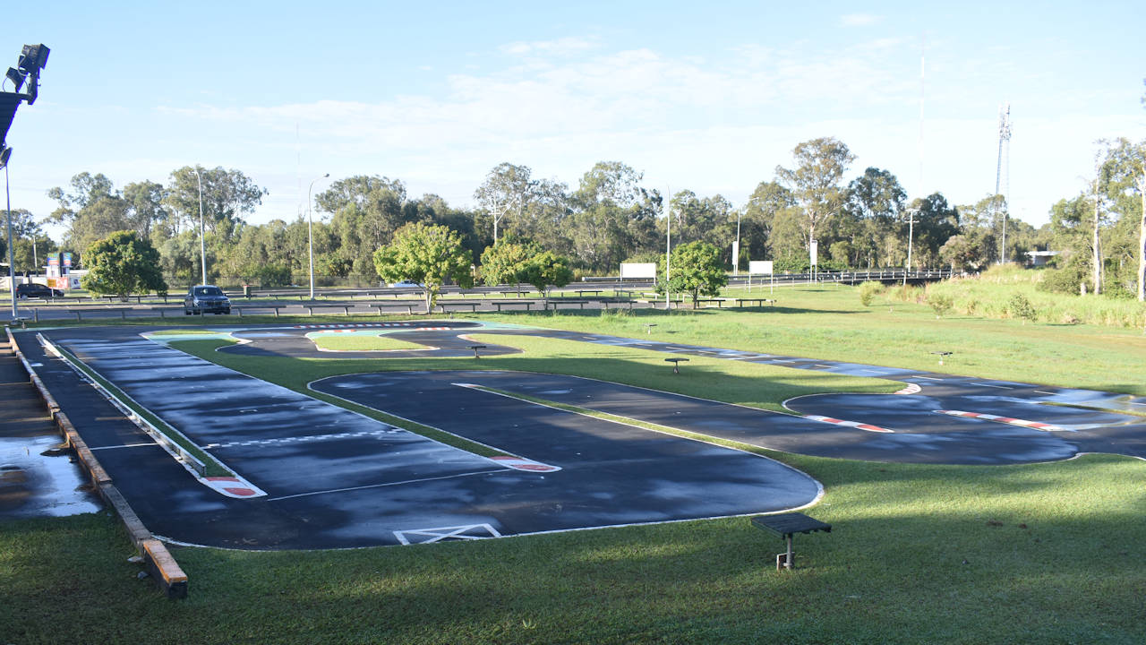
RC Park
Beside the train station is an RC track for radio controlled car racing. The track is free and open to the public. The Bayside Radio Controlled Car Club ![]()
![]() meets every week, alternating between championship racing and “Run What Ya Brung” racing.
meets every week, alternating between championship racing and “Run What Ya Brung” racing.
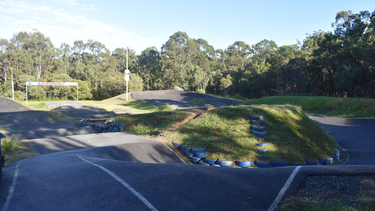
BMX Track
Bayside BMX Club ![]()
![]() has a track designed to be appropriate for beginners and challenging for more experienced riders. The track is open to the public when not used by the club.
has a track designed to be appropriate for beginners and challenging for more experienced riders. The track is open to the public when not used by the club.
The club has club coaching on Tuesday nights. Racing is held on Friday nights during the warmer months, and Sunday afternoons in the cooler months.
Continue on Tourist Drive
Continue on Wynnum Road for another 2.4 kilometres (5.8km from the start) to reach an elongated shaped roundabout. Take the second exit to continue for another 1.2 kilometres on Wynnum Road to another roundabout. Head straight through the roundabout onto Glenora St. The tourist drive then turns right onto Fox St, however, there is the first detour to a brown sign.
Wynnum Mangrove Boardwalk
To visit the Wynnum Mangrove Boardwalk ![]()
![]() , instead of turning into Fox Street turn left into Granada Street a few metres before it. Follow Granada Street for 650 metres and turn right into the entrance of Elanora Park. The parking area is another 600 metres along the entrance track, where the boardwalk begins. To return to the tourist drive, turn left onto Granada Street when leaving Elanora Park, then left onto Glenora Street ready to turn right into Fox Street.
, instead of turning into Fox Street turn left into Granada Street a few metres before it. Follow Granada Street for 650 metres and turn right into the entrance of Elanora Park. The parking area is another 600 metres along the entrance track, where the boardwalk begins. To return to the tourist drive, turn left onto Granada Street when leaving Elanora Park, then left onto Glenora Street ready to turn right into Fox Street.
The Wynnum Mangrove Boardwalk goes through the mangrove foreshore of Moreton Bay at Wynnum. The walk starts from Elanora Park and links to a bird hide overlooking tidal saltmarshes, then loops back through a forest to return to Elanora Park.
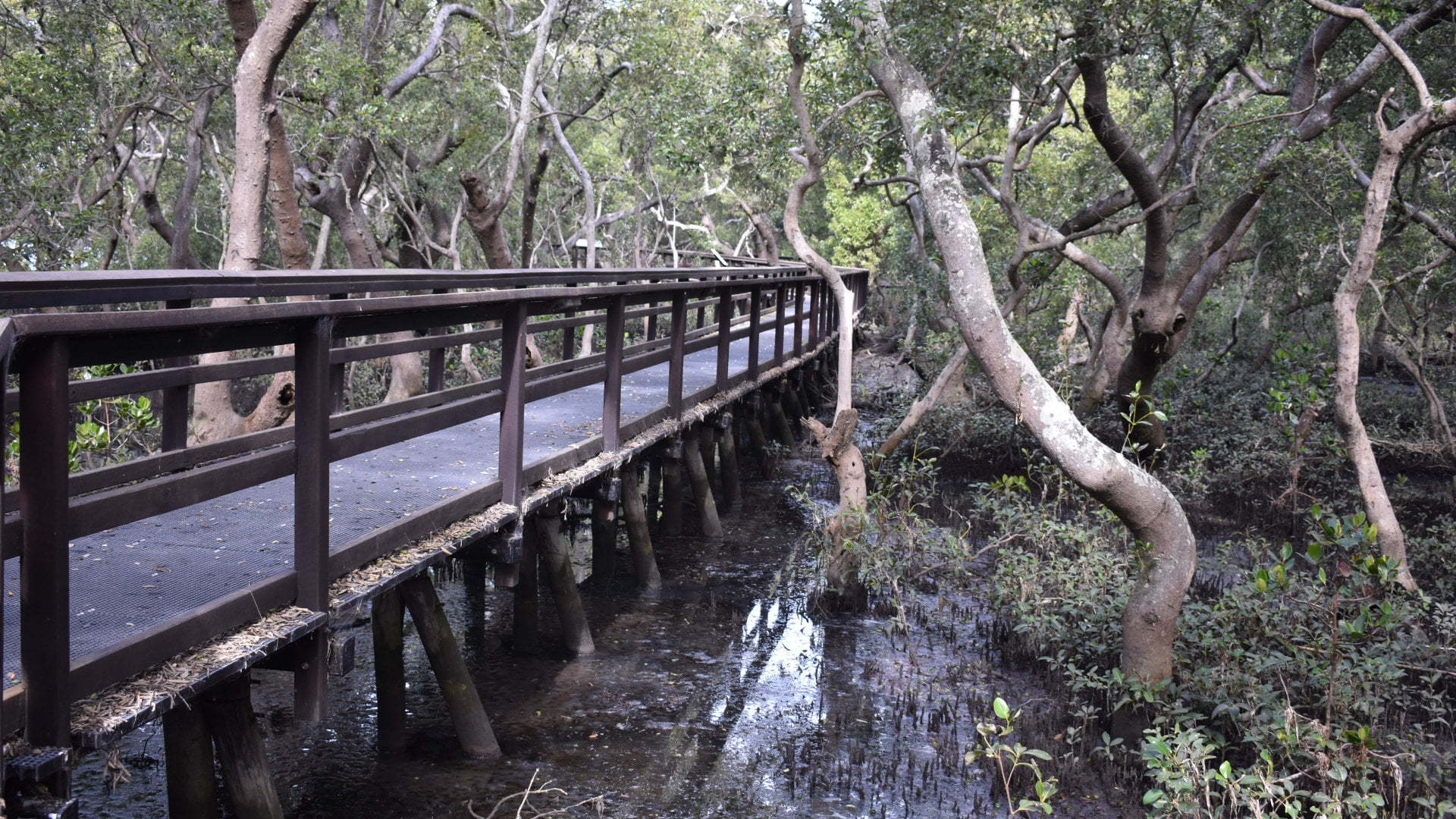
The walk starts with the boardwalk a short way from the parking area at a junction leading off the path. Depending on the tides, the water comes up to be under the boardwalk in the middle of the mangroves. The boardwalk is wide with railing on the sides.
Continue on Tourist Drive
From Glenora Street, turn right into Fox Street and follow it to the end (it becomes Cusack Parade). Turn left into Agnes Street and follow to the end, reaching Moreton Bay shoreline on Waterloo Esplanade.
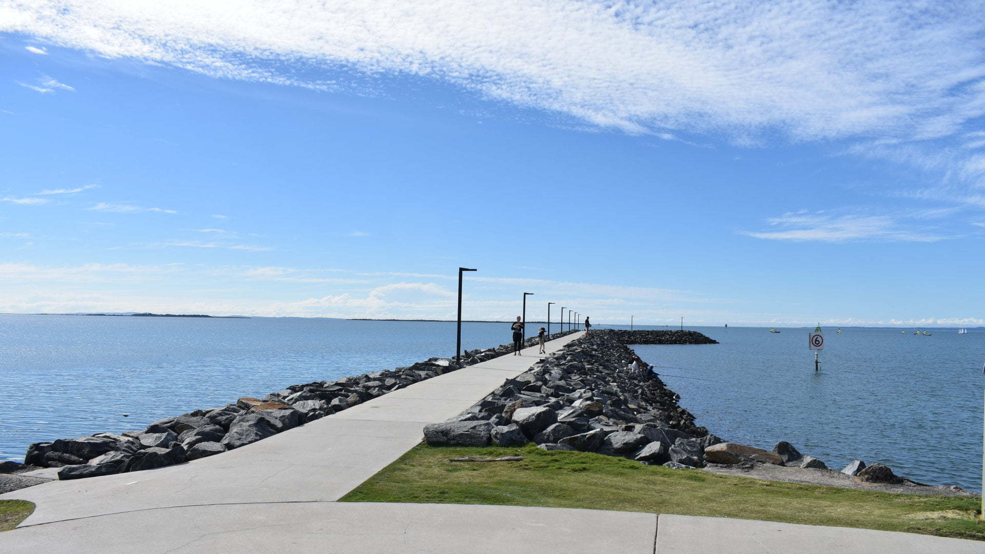
Breakwater Park – Pandanus Point
To visit Breakwater Park, it is a short detour by turning left at Waterloo Esplanade. To continue on the tourist drive, turn right instead.
Breakwater Park is a small area with sheltered picnic tables and a free BBQ. A break wall extends into Moreton Bay from Wynnum Creek, providing a protected channel for the Wynnum Creek boat ramp (on the opposite side of the creek) and boats moored in the creek.
The park has a memorial to the stolen generations of indigenous people local to the area. It was chosen for its views of Moreton Island and Stradbroke Island, as well as being near children’s homes where Aboriginal children were forcibly removed. Commemorative Sorry Day plaques were installed in 1998, as a mark of respect, apology and remembrance for the Stolen Generations.
Continue on Tourist Drive
Follow Waterloo Esplanade south for around 500 metres, becoming Wynnum Esplanade, to reach the Wynnum Foreshore.
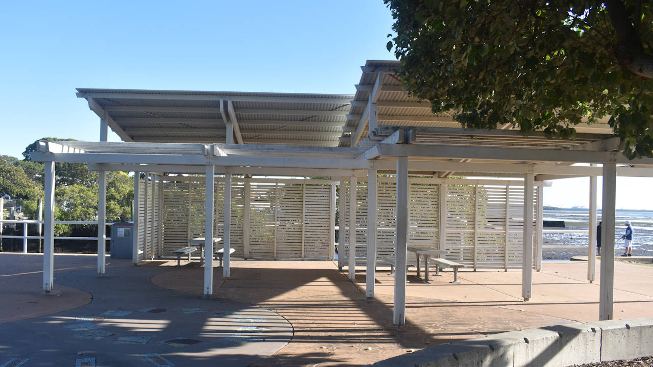
Wynnum Foreshore
The foreshore along Wynnum is a defining feature of Brisbane’s bayside suburb. In the 1880s, the potential holiday value was recognised by land speculators and the opening of the railway in1889 brought in the crowds. People would travel by horse and cart to come for a picnic or holiday. The railway created extra services to meet demand on Sundays.
With around 2.6 kilometres of pathway along the foreshore from Breakwater Park to Manly, it is a great spot for a walk and enjoy the views across Moreton Bay. The distance is just the right amount for a 5km Wynnum Parkrun ![]()
![]() as well.
as well.
Aside from the beautiful views and choices for takeaway and dine-in eateries close by, the three main features of Wynnum are the Whale Park, jetty, and the heritage recognised wading pool.
Whale Park Wynnum
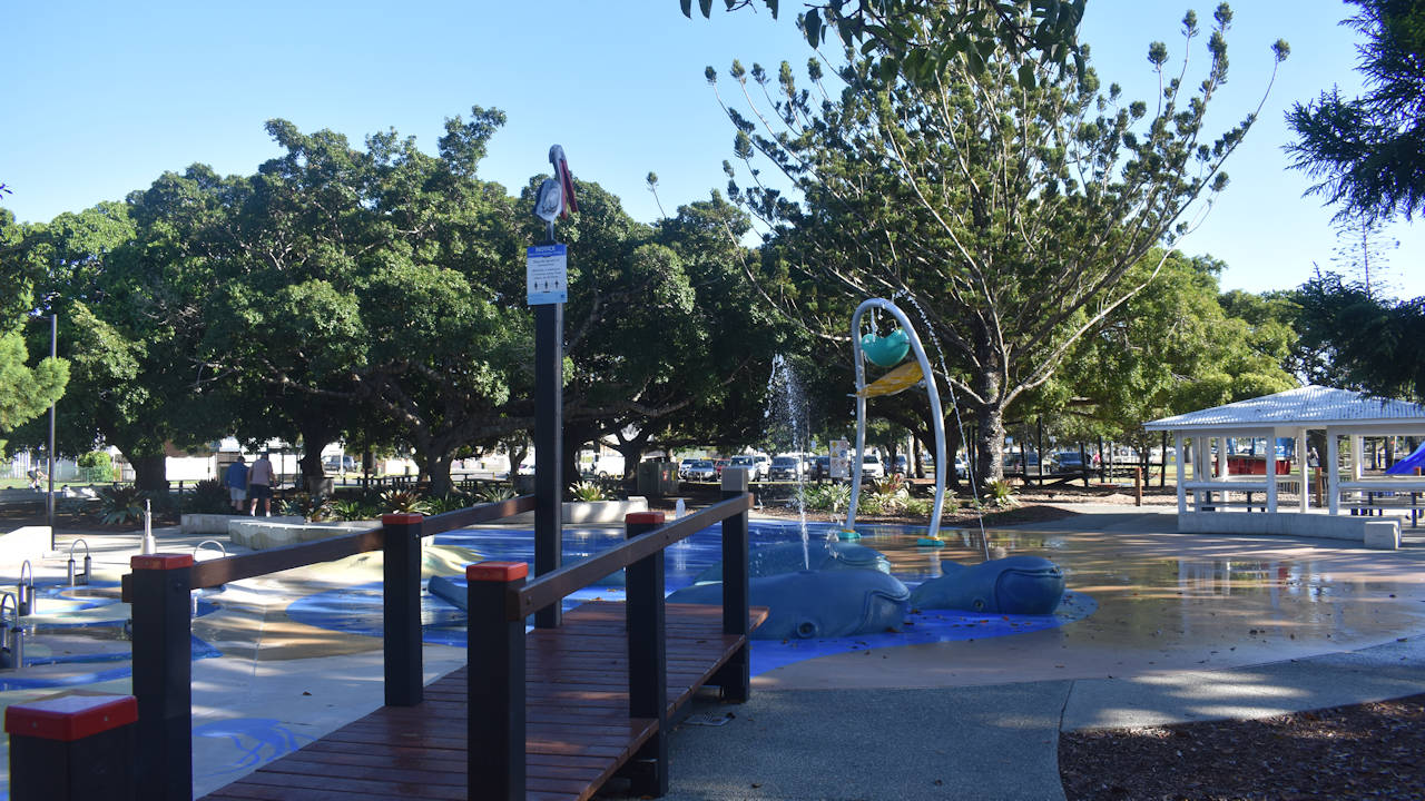
Known commonly as “the whale park”, The Water Park in Wynnum is a popular feature for young families keeping cool in the outdoors. The name is derived from the group of whales with water shooting out of their blowholes.
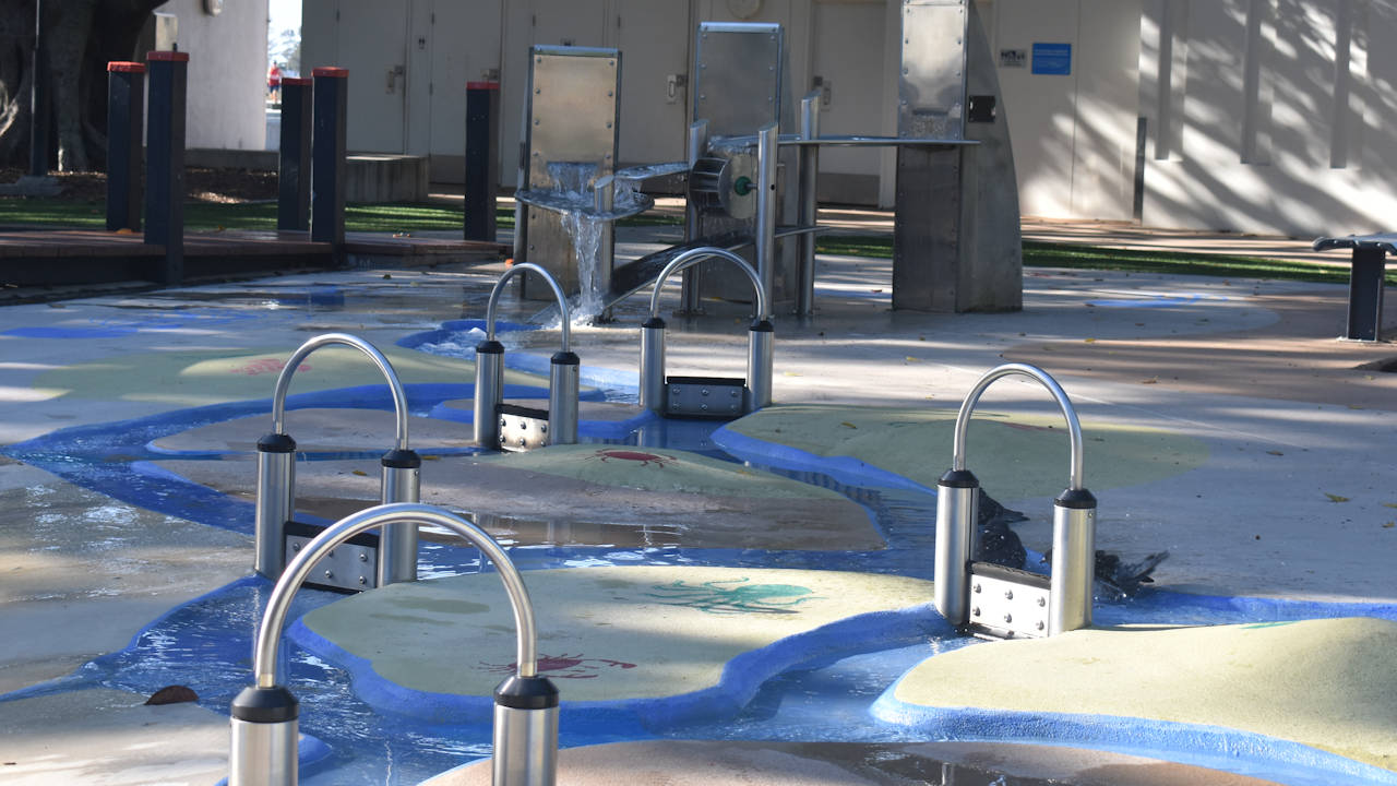
There is a spilling bucket where a bucket above fills with water before spilling its contents over the waiting children below it. Some gated water channels with different water sources adds more fun for young children to play and keep cool.
Dry options are also available with swings and structures to climb and explore.
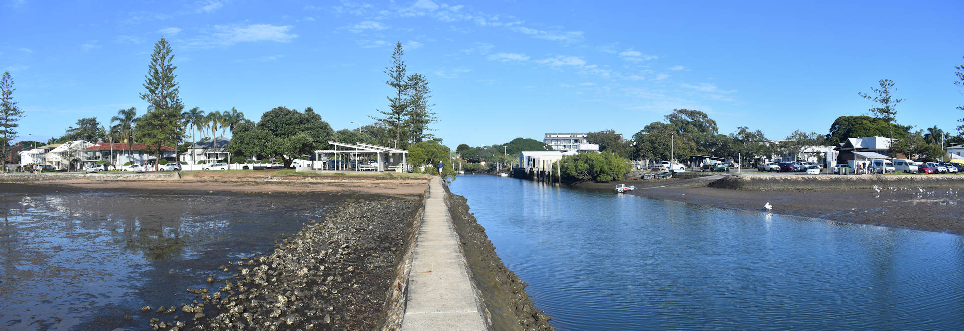
Wynnum Jetty
Wynnum Jetty was first built in 1882 as a timber jetty, known as No. 2 Jetty, the first jetty built near Wynnum Creek. A bathing enclosure and changing rooms was added later, with segregated bathing in the early 1900s with men and women swimming on separate days.
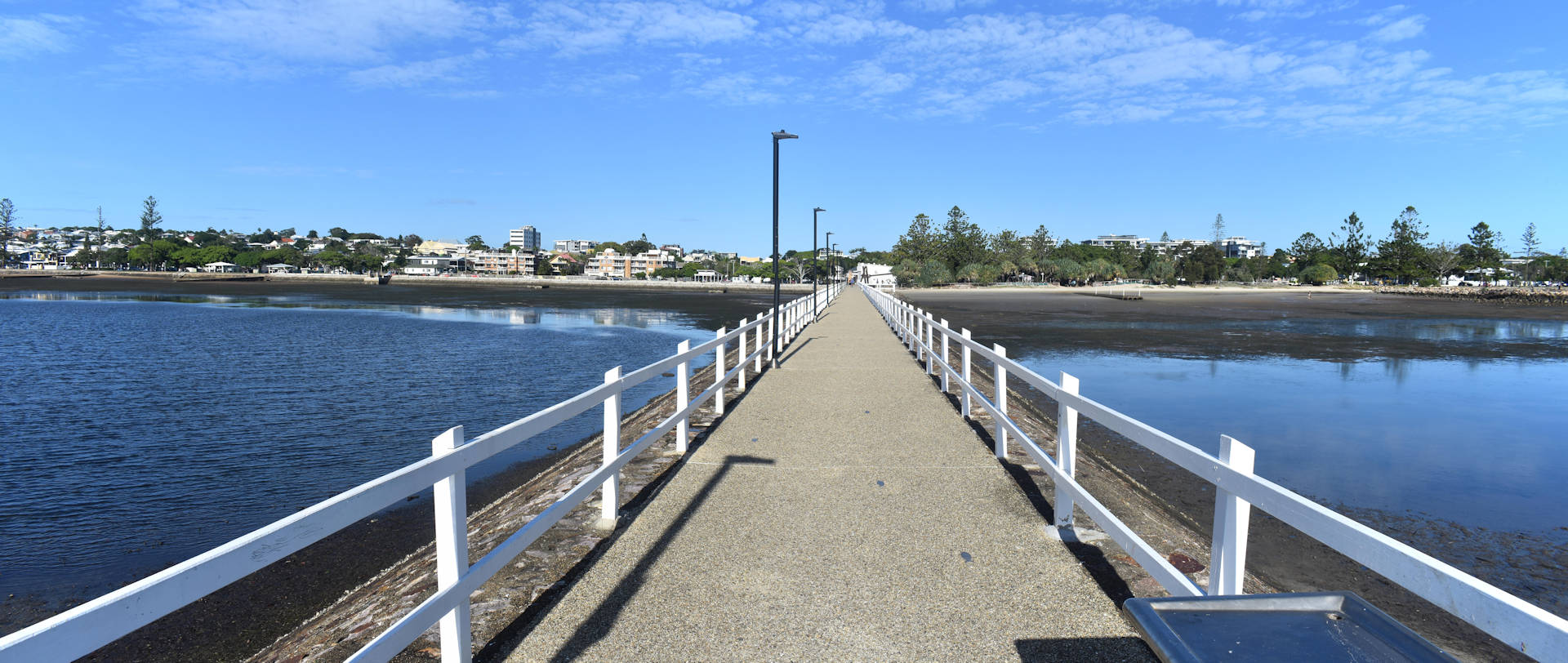
Until the railway arrive, the jetty was the most reliable way to travel to Wynnum. A boat would travel down the river and down the bay to the jetty.
The jetty was rebuilt, replacing the wooden structure with the current rock wall structure. The bathing enclosure was still in use in the 1950s but it wasn’t included after the jetty was rebuilt. Another shorter rock wall around 100 metres north creates a protected area which helps trap the sand for a sandy beach area for the Wynnum Foreshore.
At the end of the jetty is a wide section with a sheltered picnic table at each end and a fish cleaning table near the centre. Four sets of steps lead down into the water for some reason. It doesn’t seem like they are there for a practical reason as the jetty isn’t suitable for watercraft anymore.
Wynnum Wading Pool
South of the Whale Park is a large wading pool. It is quite shallow at around 50 centimetres (it has the capacity to be up to 75 centimetres), making it safe for most ages. There are accessible ramps with handrails into the water, making it inclusive for almost everyone.
The wading pool has a long history, going back to at least the early 1930s, officially opening 1933. The Wynnum parkland reserve was a project to improve existing facilities, including the wading pool, parkland, and a boat ramp. The wading pool fills from high-tide water with flood gates keeping the water in the pool when the tide goes down.
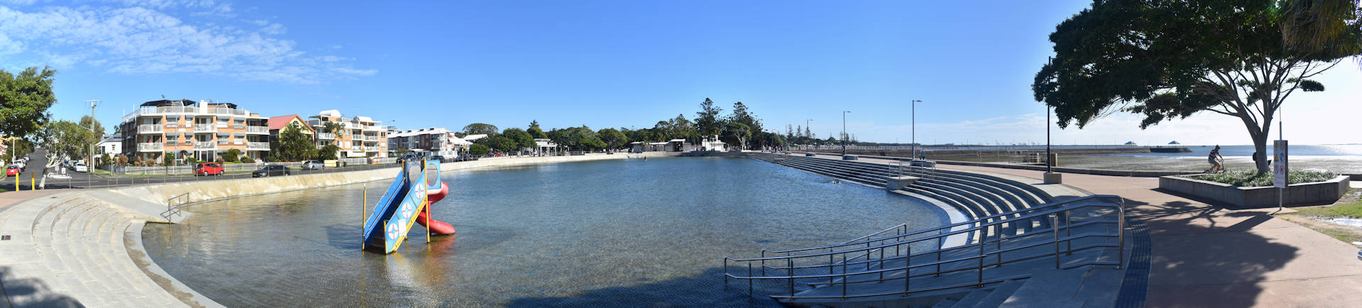
At first, it may appear to be for children. It was originally intended to be mainly for children and the small slide at one end contributes to this. It is used by adults (other than parents) getting in some early morning laps in protected and calm water or wading from end-to-end. Wading provides a great cardio workout with water resistance as you walk through the water.
There are some shady areas near, however, most of the area around the pool is sunny. The sheltered areas and toilets are close by, as are the BBQs, around the Whale Park.
Continue on Tourist Drive
Follow Wynnum Esplanade south for around 1 kilometre, becoming Esplanade, to reach George Clayton Park.
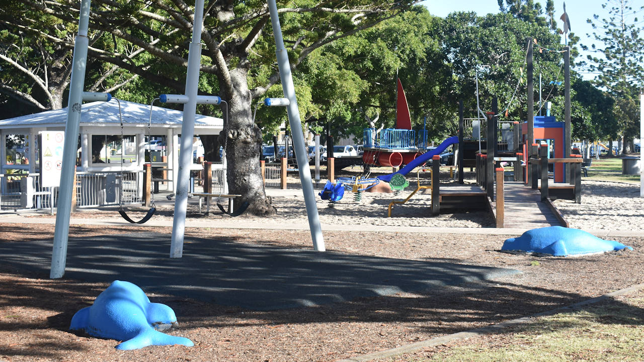
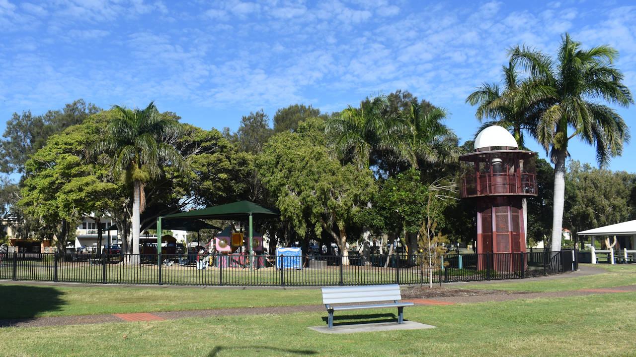
George Clayton Park
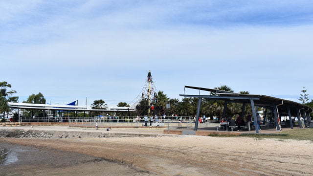
Often known as Bandstand Park or Lighthouse Park, George Clayton Park is a popular and busy park. The “lighthouse” in the children’s playground is a defining feature that no doubt brings families to enjoy the space.
The lighthouse is a steel structure that looks like a lighthouse. In the centre is spiral stairs to the viewing platform at the top. The viewing platform is caged all the way around so safe for kids to climb up to and enjoy the view.
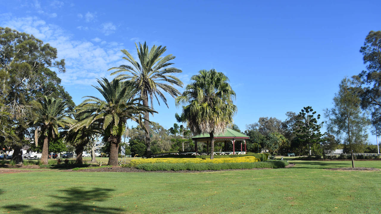
The bandstand is a building structure where events are often held. For example, the Wynnum Manly Jazz Festival ![]()
![]() is held every year on Father’s Day with local jazz bands performing from the Bandstand.
is held every year on Father’s Day with local jazz bands performing from the Bandstand.
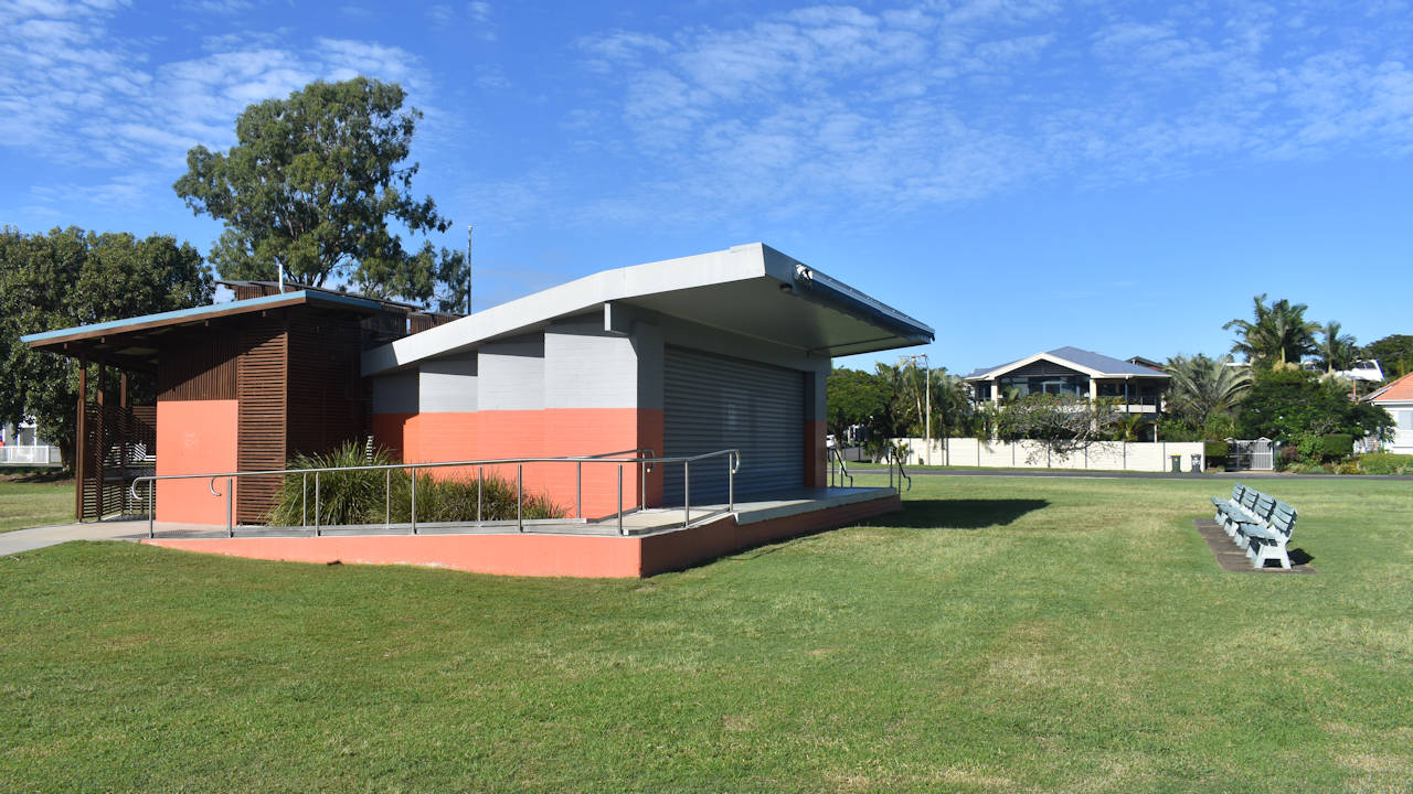
There are great facilities at George Clayton Park, including toilets, picnic tables (some in shady spots, some sheltered), and free BBQs for use. There are no food outlets, however, the mobile coffee van was getting a constant stream of customers getting their morning coffee.
George Clayton
The park is named after George Clayton, who represented Wynnum Manly in the Brisbane City Council from 1952 to 1957. He arrived in Wynnum to visit relatives in 1920 as a 30-year-old. On his way to book a ticket to Rockhampton, he bumped into a friend who told him of a job laying pipes in Wynnum’s first water reservoir. He worked for the Brisbane City Council Water Board for 20 years.
Drevesen Park
Next to George Clayton Park is Drevesen Park. It has green space and a rotunda. There isn’t much in the way of facilities, however, the facilities in George Clayton Park are close. The park is named after Robert Drevesen, who contributed to setting up the Darling Point Sailing Squadron. He received numerous awards for community service and sport, including sailing.
Continue on Tourist Drive
Follow Esplanade south for around 1 kilometre to Fairlead Crescent, becoming Esplanade, to reach Fairlead Crescent in Manly. From here, you can access Norfolk Point, the Manly Visitor Information Centre, and Bayside Park including Manly Playground.
Norfolk Point
Norfolk Point ![]()
![]() forms the northern edge of Manly Boat Harbour and extends out as a rock wall for the mouth of the harbour. A path leads to the end of the wall providing fishing spots off the rocks on either side of the wall.
forms the northern edge of Manly Boat Harbour and extends out as a rock wall for the mouth of the harbour. A path leads to the end of the wall providing fishing spots off the rocks on either side of the wall.
Wynnum Manly Visitor Information Centre and William Gunn Jetty
The Wynnum Manly Visitor Information Centre is in the middle of the Manly Harbour, up the end of Wyvernleigh Close, on the William Gunn Jetty.
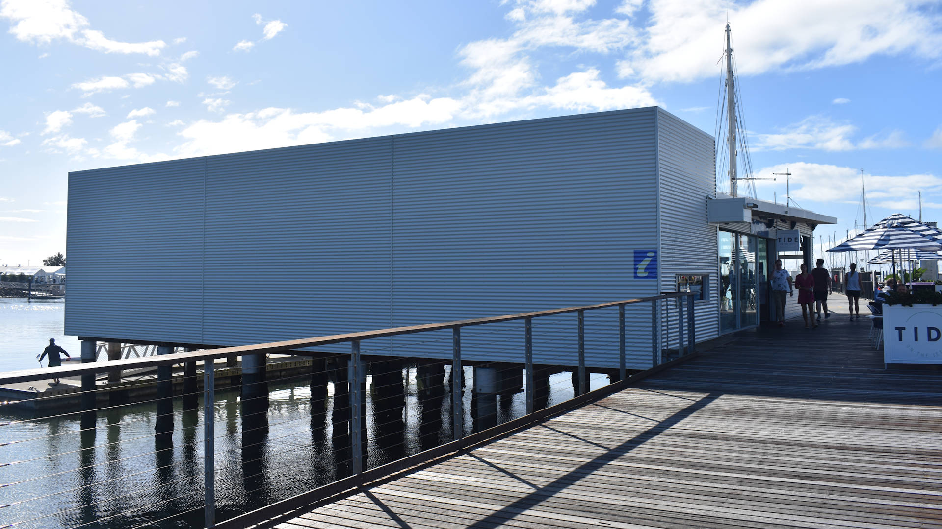
William Gunn Jetty, originally the No. 3 Manly Jetty, was named after William Gunn who served in WW1 and contributed to the Manly community.
Bayside Park
A large park area that is great for a gathering with family and friends. There are covered areas with picnic tables and BBQs with a climbing spiderweb playground in between. Another playground has swings for those less drawn to climbing.
A large toilet block is nearby with flushing toilets and lots of open grass space to run around or set up your own picnic space. For those who don’t want to bring lunch or cook something on the BBQ, there are a cafe and seafood shop across the road, among others.
Continue on Tourist Drive
Turn left out of Fairlead Crescent and follow Royal Esplanade south for around 1 kilometre to Davenport Drive.
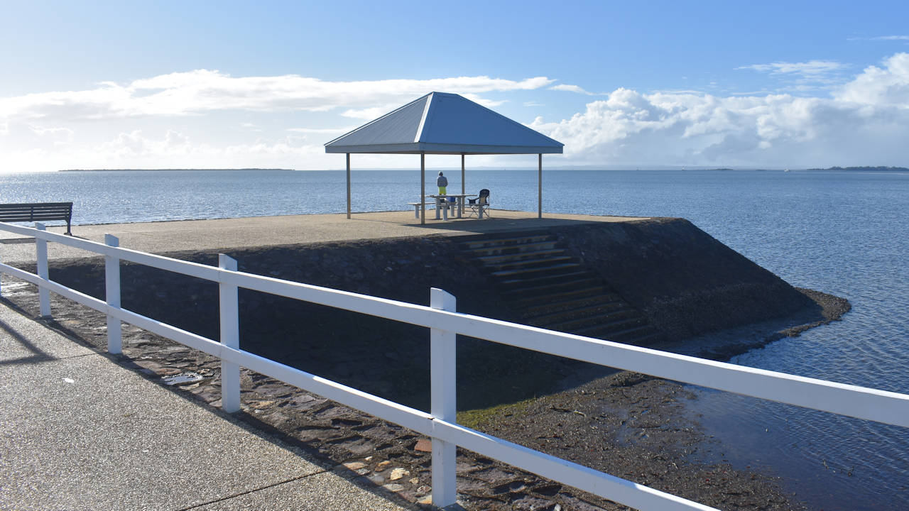
Inspiration Point
Located on the southern edge of Manly Harbour is Inspiration Point is a 1-kilometre return detour off the tourist drive. Turn left off the Royal Esplanade into Davenport Drive and follow it to the end.
It is a simple park but has a large fishing platform at the end of the point. A shelter has two fish cleaning tables for when you catch your lunch or dinner. You’ll need to head up to Lota Park for a BBQ to cook it on.
Aside from fishing, Inspiration Point is the 2-kilometre turn around point for the Lota Parkrun and a dog off-leash area. If you are not heading here for the fishing, the dog off-leash area, or running in ParkRun, Inspiration Point isn’t the most inspiring. The view over the bay is great but it is positioned next to a boat storage yard.
Continue on Tourist Drive
Turn left out of Inspiration Drive and follow Royal Esplanade south for around 1 kilometre to Davenport Drive.
Lota Park
On the left side is Lota Park, just before leaving the Moreton Bay shoreline for Manly. Lota Park
Continue on Tourist Drive
Turn right into Alexander Street and follow to the end, then turn left into Whites Road.
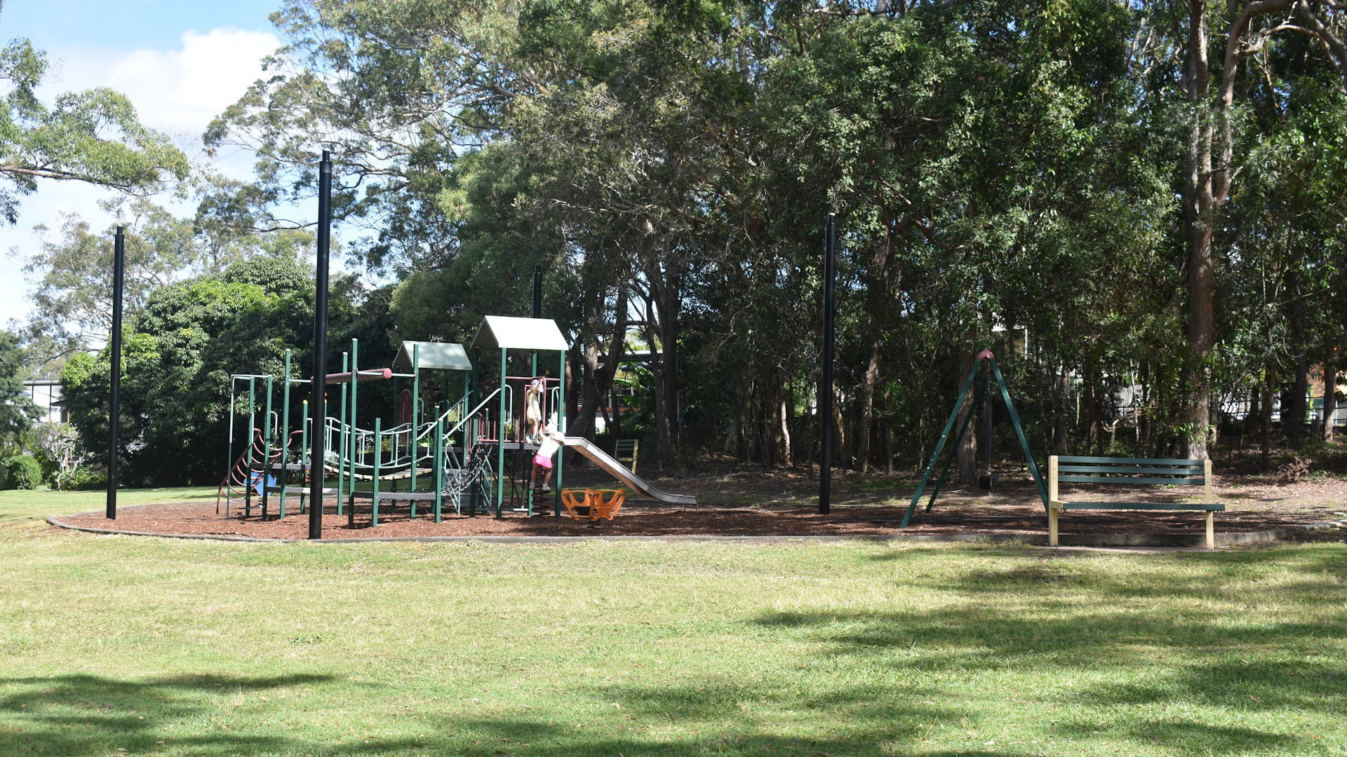
Bill Lamond Park
Continue on Tourist Drive
Lota Creek Boadwalk
Melaleuca Environmental Park
Head to Melaleuca Environmental Park, turning into Herbert Street off Whites Road and following Herbert St to the end. Turn left then park after the bend to the right.
Melaleuca Environmental Park ![]()
![]() has been created by The Melaleuca Park Community Association in the late 1980s by clearing the area of exotic grass and replanting with native plants. The environmental park is 22 hectares set in the Lota Creek catchment area.
has been created by The Melaleuca Park Community Association in the late 1980s by clearing the area of exotic grass and replanting with native plants. The environmental park is 22 hectares set in the Lota Creek catchment area.
With 22ha of reserve and walking trails to follow, those inclined can go for a wonderful walk through the bushland. Some of the trails are wide and clearly defined to follow, though there are a couple of narrower and rougher tracks to follow if you prefer walking through more dense vegetation.
Bayside Bushland
Continue on Tourist Drive
Follow Whites Road for 2.7 kilometres (2.4 kilometres from Herbert Street, or 1.9 kilometres from Bayside Bushland) to the end and turn left onto Manly Road, then left again onto Green Camp Road. Keep in the left lane and veer left onto Rickertt Road towards Birkdale.
Tingalpa Creek Pontoon
The Tingalpa Creek Pontoon parking area is along Rickertt Road, 1.8 kilometres turning off Green Camp Road and just before crossing the bridge over Tingalpa Creek.
Wellington Point Recreation Precinct
Ormiston House
Instead of turning right at the roundabout, continue straight through then left into Willington St. Follow to the end of for 1.8 kilometres to reach the entrance of Ormiston House.
Historic Ormiston House is regarded as the birthplace of the Australian Sugar Industry. It was built by Hon. Captain Louis Hope and dates back to 1862.
The beautiful house is considered to be one of the finest examples of colonial architecture in Queensland. The meticulously restored house, expansive grounds and beautiful gardens overlook stunning Moreton Bay to the East.
It is open on Sundays from February to December, from 12pm until 4pm. Learn more about this historic house with a tour around the grounds for a fee, or pay for a Devonshire Tea. Enjoying a devonshire tea on the veranda of Ormiston House is a great way to take a break in the early afternoon.
Cleveland Heritage Precinct
Instead of turning right into Passage Street, head straight through the roundabout to continue on Shore Street West towards the Cleveland Heritage Precinct, around 8 kilometres detour off the Southern Moreton Bay Tourist Drive route.
Grandview Hotel
The Old Courthouse
Cleveland Point
Redland Museum
(sign cnr Cleveland Redland Bay Rd and Long St)
Turn left at the lights into Colburn Avenue towards Victoria Point.
Victoria Point Environmental Precinct
Instead of continuing towards the right on Colburn Avenue, turn left towards Point Halloran at Pt O’Halloran Road.
YMCA Family Sporting Centre
Victoria Point Recreation Precinct
Air Sea Rescue
Island Ferries
Southern Bay Island Vehicle Ferry
Redland Bay Marina
Continue on Tourist Drive
Return to the tourist drive on Meissner Street and turn left onto Queen Street. Follow Queen Street to the second roundabout and turn right onto School of Arts Road. Follow to the end with a left bend before crossing Cleveland Redland Bay Road at a large set of traffic lights, continuing straight ahead on German Church Road towards Mount Cotton. Follow for 5.4km to the end, turning right onto Mount Cotton Road
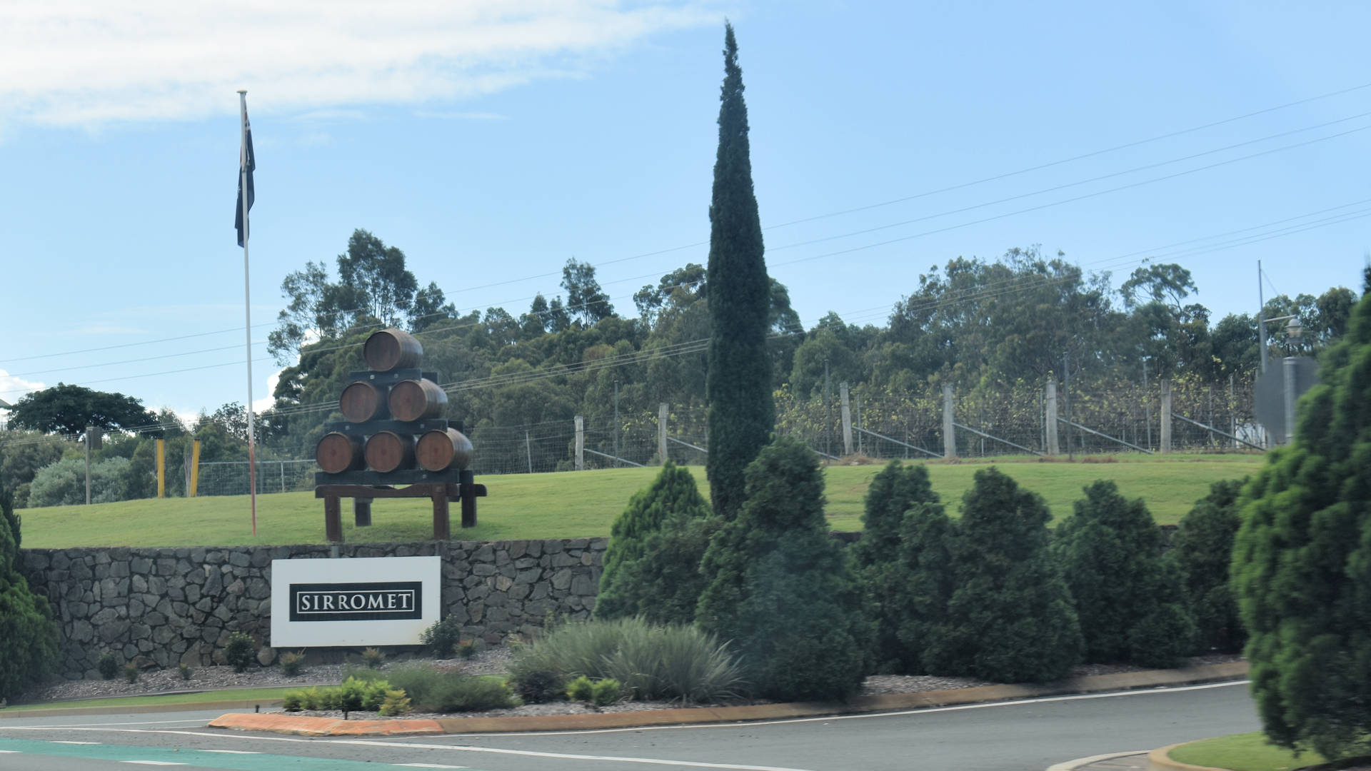
Sirromet Wines
Follow Mount Cotton Road for 5 kilometres to reach the entrance of Sirromet Wines ![]()
![]() . The entrance track is 600 metres to the parking area.
. The entrance track is 600 metres to the parking area.
Sirromet Winery is a family-owned winery at Mount Cotton on the south-east outskirts of Brisbane. Set on over 560 acres surrounded by natural bushland, it is a beautiful location close to the city.
It is also the host of another Parkrun ![]()
![]() on the tourist drive, an out and back course starting at grass hill in front of the Tuscan Terrace Cafe through the scenic grounds.
on the tourist drive, an out and back course starting at grass hill in front of the Tuscan Terrace Cafe through the scenic grounds.
Continue on Tourist Drive
From Sirromet Wines, continue north on Mount Cotton Road for 1.8 kilometres, then turn left into West Mount Cotton Road.
Venman Bushland National Park
From turning into West Mount Cotton Road, the entry to Venman Bushland National Park ![]()
![]() is 6.4 kilometres on the left, with a short 350-metre access track to the parking area.
is 6.4 kilometres on the left, with a short 350-metre access track to the parking area.
The Venman Bushland National Park is a conservation area with an easy bush walking trail, picnic area, wood BBQs and toilets. It features open eucalypt forest and sections of lowland rainforest in 415 hectares of bushland.
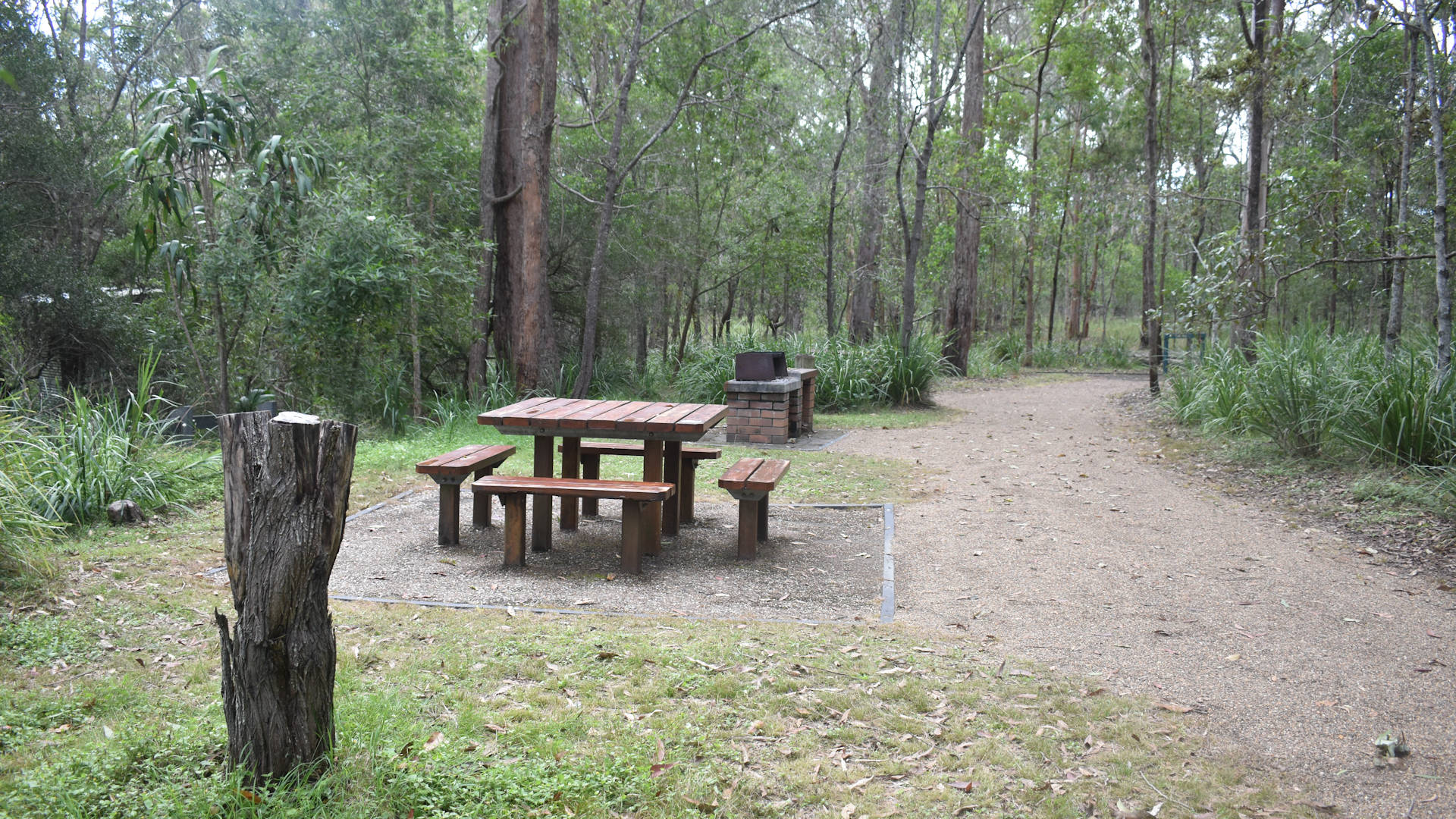
There is a day use area with picnic tables and wood fired BBQs, however, the main recreational use of the area is trail walking. The gates close at 5.30pm each night, so when planning walking from this area, make sure you allow time for returning and leaving the park.
Continue on Tourist Drive
Continue south on West Mount Cotton Road for another 3.5 kilometres to the end and turn right onto California Creek Road. Follow California Creek Road to a roundabout, turning right and contining to a set of traffic lights. Turn right at the lights onto Beeleigh Redland Bay Road and follow 1.9 kilometres to the end of the Southern Moreton Bay Tourist Drive.
Esplanade -> right Alexander St — left Hindes St -> left Whites Rd -> left Manly Rd -> left Green Camp Rd -> left Rickertt Rd–Quary Rd -> left roundabout Birkdale Rd -> right roundabout Main Rd -> left Old Cleveland Rd East -> right Northern Arterial Rd -> left roundabout Shore St West -> right roundabout Passage St -> bend Long St ->
left Bloomfield St — Cleveland Redland Bay Rd -> left Colburn Ave -> right Link Rd–Benfer Rd -> left Cleveland-Redland Bay Rd -> left Boundary St ->
Eagleby Wetlands (sign end of Logan St)