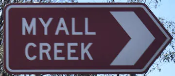
Myall Creek Parklands is a defining part of Dalby in its history and as a drawcard for enjoying the natural environment along the creek. The parkland is suitable for a variety of activities, including walking, bike riding, spotting birdlife, picnic rest stop, and playground.
The main area the brown sign directs you to is a stretch of Myall Creek between the Charles Drew Bridge on the highway and Mercy Bridge on Jimbour Street. It is at this section of Myall Creek you can find all of the facilities together, including the playground, free BBQs, picnic tables, and bins. There is also plenty of parallel parking available along this part of Myall Creek.
Mercy Bridge was named after the Sisters of Mercy, needing a suitable crossing over the Myall Creek to attend mass. Originally, it was simply a large log spanning across the creek, later replaced with a timber footbridge. The timber footbridge was extensively damaged during the 2013 floods, now replaced with a 24-metre composite fibre foot bridge.
The pathways along Myall Creek extend to a greater length following the creek. Continue further passed the Mercy Bridge takes you to Edward St where a causeway crosses over. The other side of the causeway is another brown sign, marking where the first settlement of Dalby in 1941. The paths continue along Myall Creek in this direction to Len Overington Bridge.
Heading the other way, the pathways cross under the bridge of Warrego Highway and onward, to the Jacko Cavanagh Bridge and Amas Street Bridge.
Dalby Parkrun starts at the parklands, near the causeway of Edward St. The parkrun course predominately follows along Myall Creek.
Myall Creek formed part of a corridor for western indigenous people making their way to the Bunya Mountains, typically for the Bunya feast. An indigenous boy, Henry Dennis, established a camp along Myall Creek in 1841, eventually becoming the township of Dalby.
The creek joins the Condamine River, the longest river system in Australia, downstream from the Lowdown Bridge on the Moonie Highway.