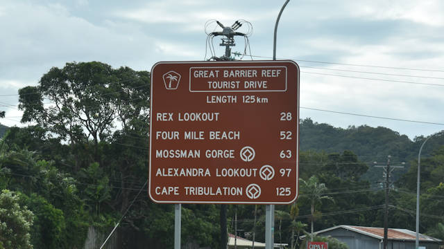
The Great Barrier Reef Tourist Drive follows the coast from Cairns to Cape Tribulation, crossing the Daintree covering a distance of about 125 kilometres. The distance will be longer with stops and visits to various places of interest on the way.
The tourist drive takes you along two World Heritage Areas that meet along the shores. The Great Barrier Reef and the Wet Tropics of North Queensland bring you views over the Coral Sea and into ancient rainforests.
The Great Barrier Reef doesn’t seem like a long drive and can easily be done in a single day. If you are like many who visit this area from afar, much more time is needed to see what this drive has to offer. Some stops may take little time to experience it while others you could spend hours.
How much time you spend at each will depend on what you are wanting to see and experience from each destination.
From Cairns to Port Douglas
The tourist route starts about 10 kilometres north of Cairns at Smithfield, then continues north along the Captain Cook Highway through Palm Cove, Ellis Beach, Thala Beach, and Port Douglas. The drive continues north into Mossman then along the Mossman Daintree Road before turning into Cape Tribulation Road, crossing the Daintree River on a ferry. Cape Tribulation Road finishes the drive with Mount Alexander, Cow Bay, Diwan, Thornton Beach, Myall Beach, and Cape Tribulation itself.
Start of Tourist Drive
The start of the drive can be found travelling north along the Captain Cook Hwy in Smithfield. The brown sign at the start is north of the roundabout where Kennedy Hwy meets Captain Cook Hwy, just north of the Smithfield Shopping Centre entry and exit northbound on the highway.
Smithfield
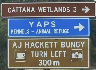
The brown signs start almost immediately, many of the brown signs are a short detour off the main tourist drive. Drive north on Captain Cook Highway for 1.5km to reach the first two approaching a roundabout at McGregor Rd. For the adventurous, turn left for the A J Hackett Bungy (1km detour), or for a more sedate experience head for the Cattana Wetlands to the right (2.5km detour).
As the name suggests, AJ Hackett Bungy is bungy jumping, the only one in Australia and run by the man who started bungy jumping in New Zealand. They also have a giant swing with up to 3 people in the one swing.
Travel 2.5km further on Captain Cook Drive and you reach the turnoff for Trinity Beach, a 2.5km detour down Trinity Beach Road. It is the first of a few well-known beaches north of Cairns. Trinity Beach has a walkway along the beach, access to the Earl Hill walking trail and the scenic Taylor’s Point at the southern end of the beach.
Continue another 3.7km and you reach the turnoff for Clifton Beach, less than 700 metres off Captain Cook Highway. Clifton Beach is quieter but you will still find facilities along the beach, including BBQs, a playground at the northern end.
3.4km further along Captain Cook Drive, you will reach the turnoff for Palm Cove. Palm Cove is more touristy with lots of accommodation, places to each, and a walkway along the beach and the Palm Cove Jetty at the northern end.
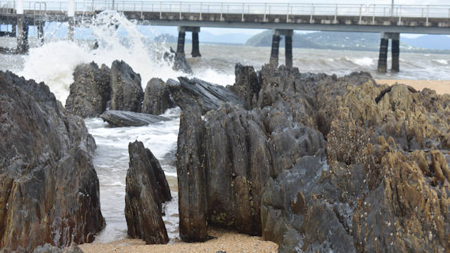
An interesting rocky outcrop where the rocks have been tilted upwards and worn away by the ocean waves. Double Island and Haycock Island can be seen offshore.
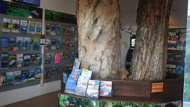
Palm Cove Visitor Information Centre is along the front street and shows a wonderful synergy of buildings and trees with the information centre built around a large White Tea Tree (Melaleuca Leucadendron) growing through the roof. The trees look amazing with some of the trunks look like they are twisted.