
Teviot Falls is along the Falls Drive on the edge of the Scenic Rim, close to the border of Queensland and New South Wales. The falls are from the Teviot Brook in Teviot Gap, near the head of the Condamine River between Boonah and Killarney. Downstream, Teviot Brook feeds into Wyaralong Dam ![]()
![]() .
.
Unlike the other falls on the Falls Drive, Teviot Falls are not clearly sign posted, even though it is listed on the brown signs for the Falls Drive. The lookout is about 4km after crossing Teviot Brook downstream (coming from Boonah direction), with a small area on the side of the road to park on, with the views opening a hundred metres or so before getting to the top. If you go over the cattlegrid you have just passed the lookout (or about to arrive at it if coming from Killarney).
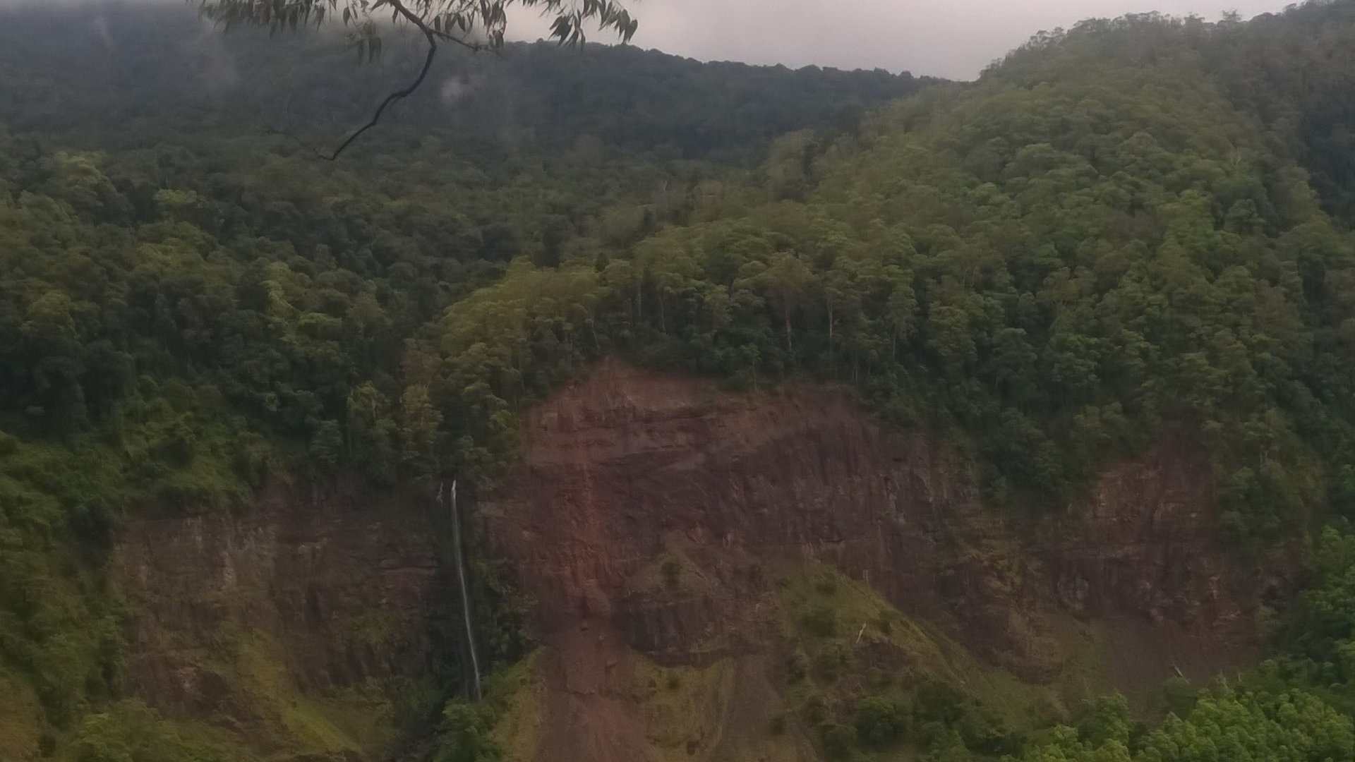
The falls are viewed across and up the valley gap, a fair way across at somewhere between 600-700m. Finding Teviot Falls is easy if there is plenty of water flowing, but can be difficult to spot if you don’t know where to look, especially if it is quite dry.
The falls are amongst bare rock face with old landslides, greenery growing on the landslide where the falls flow over it.
The view is becoming obscured by tall trees growing up the side of the hill. I found a better view can be found on the side of the road about 100m or so back down the hill. The road is narrow and there is not a lot of space, so care is required to observe vehicles driving passed you.
Google Maps shows a road heading towards the head of Teviot Falls, called Brett Rd. There isn’t really anything that resembles a road anymore, it is quite overgrown. This is the start of the Mt Superbus Trail. I haven’t walked it, so I can’t say what it is like from personal experience, but it is supposedly for experienced bush walkers only, requiring navigation. It would be nice to know if a partial walk along Brett Rd provides any better viewing without too much difficulty. If you know of this walk, please leave a comment below.
If you want to have a walk with falls, and don’t have advanced bush walking experience, there are other falls with walks, including a couple of walks at Queen Mary Falls, and a bit more challenging walk to Browns Falls.
To get there:
![]()
![]() There is no brown sign at the destination, only at the start of The Falls Drive.
There is no brown sign at the destination, only at the start of The Falls Drive.
From Boonah, head south for just over 14km to Carneys Creek Rd, and turn right at the Falls Drive brown sign. A brown signs summary of the falls and lookouts are shortly along the road. Continue for 14.6km to Head Rd, and turn right with the Falls Drive brown sign. You will cross Teviot Brook 4 times, the forth about 7.1km after turning into Head Rd. Head Rd starts a steep climb shortly afterwards, with the lookout for Teviot Falls about 4kms from the last crossing of Teviot Brook. If you go over the cattle grid at the top of the steep section, you have gone passed the lookout. Brett Rd is just passed the cattle grid.
From Killarney, head south along Willow St in town, which becomes Acacia St, then Border Road. Continue for 4.3km to Spring Creek Road and turn left at the Falls Drive brown sign. A brown signs summary of the falls and lookouts are shortly along the road. Continue for 27.7kms, and the area to stop for viewing Teviot Falls is on the left, just after crossing the cattle grid. You will pass Brown Falls at 2.4km, then Dagg Falls Lookout at 3.5km, then Queen Mary Falls at 6.8km, then Carrs Lookout at 15.1km, then Condamine River Road turnoff at The Head at 21.1km, and finally the lookout for Teviot Falls at 27.7km from Border Rd.
From Killarney, you can alternatively drive along Condamine River Road, for the 14 River Crossings drive. This makes a good return drive as a loop with the other falls. This is only for vehicles with high clearance. Some of the river crossings have large rocky bottom with flowing water, so not suitable for cars. Also if there has been rain, check if the roads are flooded. They tend to go down quickly, but they rise quickly also. Head south along Willow St in town, which eventually becomes Border Road. Continue for only 3.3km, turning left into Brosnans Rd. Continue straight ahead, which will become Condamine River Road. Keep following Condamine River Road, crossing over fords and rocky crossings, for 19.1km where the road comes out at Spring Creek Rd. Turn left, and the lookout for Teviot Falls is 6.6km, just after crossing the cattle grid.
Cost: Free
Hours: Anytime, daylight recommended for views
Toilets: No
Bins: No
Tables: No
Seating: No
Water: No
Food: No
Wheelchair accessible: Yes
Pets: Not specified
Playground: No
BBQ: No
Links:
https://www.aussiebushwalking.com/qld/main-range/mount-superbus

