


The Border Loop Lookout is in the Border Ranges National Park ![]()
![]() , close to the Queensland and New South Wales border.
, close to the Queensland and New South Wales border.
The lookout has views to the south over Grady’s Creek where the railway and Lions Road descend to, with hills still a barrier of the high mountains into the valley.
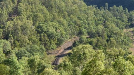
The name of Border Loop Lookout comes from the railway line crossing over the border behind the lookout and the railway line forming a loop under itself down the valley from the lookout to reduce the rate of decline down the steep hills.
Part of the railway line can be seen from the lookout. Not much is visible and the loop itself can’t be seen at all. The tunnel the railway line enters can be seen from Lions Road further down.
The railway line opened in 1930 to become the new Sydney to Brisbane railway. A key significance is the railway line has the same standard gauge used in New South Wales all the way to Brisbane. The railway line replaced the original interstate railway line from Tenterfield to Toowoomba via Wallangarra Railway Station ![]()
![]() on the border where the Queensland narrow gauge was used the rest of the way to Brisbane. The railway line through Wallangarra ultimately closed a little over 40 years later in 1972.
on the border where the Queensland narrow gauge was used the rest of the way to Brisbane. The railway line through Wallangarra ultimately closed a little over 40 years later in 1972.
The lookout area has good facilities for a remote location, typical of those found in national parks. The toilets are long drops but with newer designs, they don’t have the awful aromas they typically come with.
There are some picnic tables, a great spot to have a break with some views and the trees were providing plenty of shade, although it was late in the afternoon.
There are information boards with information about the construction of the border loop railway line and Lions Road created to service the construction of the railway line.
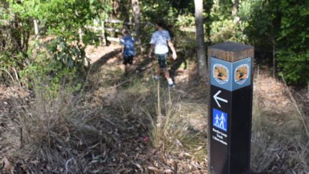
The Border Loop Walk is an easy grade 2 walk through the World Heritage listed rainforest. The walk is about 1.5km circuit walk from the parking area at the lookout, taking around 30 minutes.
We didn’t see any koalas but they are known to be in the area, so be sure to look up during the walk and you may see one.
To Get There
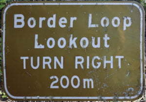
From Rathdowney Visitor Information Centre in Queensland, head north back to the service station and turn right into Running Creek Rd just before it. Continue along Running Creek Rd for 23.6km towards Kyogle to the Queensland and New South Wales border and the start of Lions Rd. At the border is a donation box for using Lions Road, add a gold coin donation. Follow Lions Rd for 2.3km and turn right into Border Loop Rd, with a brown sign 200m before it. The Border Loop Lookout parking area is about 500m further on.
From Kyogle, head north along Summerland Way for about 18.5km, passing through Wiangaree, and turn right into Gradys Creek Road with the brown sign for “Brisbane via Lions Road”. Follow Gradys Creek Rd and Lions Rd for around 21km and turn left into Border Loop Rd, with a brown sign 200m before it. The Border Loop Lookout parking area is about 500m further on.

