The best place to see the Sunshine Coast from Noosa to Caloundra is from the summit of Mount Coolum, a relatively easy difficult walk. It is a 1.6km return class 4 track, taking around 2 hours including time to take in the views.
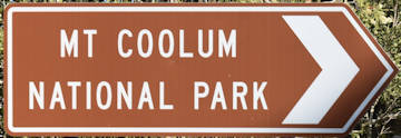
We have seen the brown sign for Mount Coolum National Park driving up the Bruce Highway heading north to wherever it is we were heading to. “We still haven’t gone to Coolum” is regularly said as we pass the brown sign yet again.
Today, we left home specifically to climb the mountain and tick it off our brown bucket list. Following Google’s directions, we didn’t see any brown sign for it but we captured it afterwards (in addition to the one on the highway many times previously).
Before turning into the street, we knew it was going to be busy because there were cars packed on the side of the road outside the parking area. With a beautiful 28 degrees in the middle of winter, the Sunshine Coast put on a beautiful day for us and many others alike.
Most welcoming was a coffee van permanently parked at the entrance of the walking trail. There are no bins on the walking trail so leave the coffee until after the walk or make sure you can carry any waste until you return.
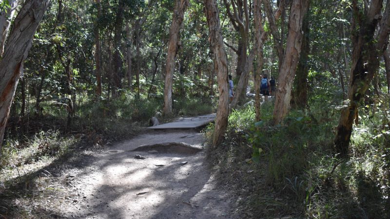
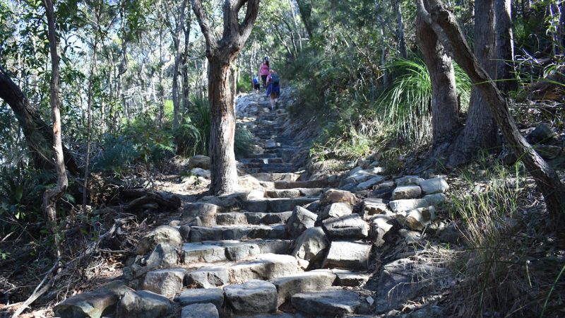
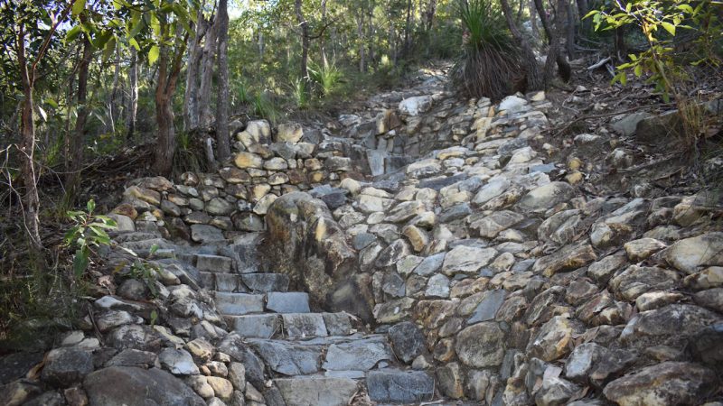
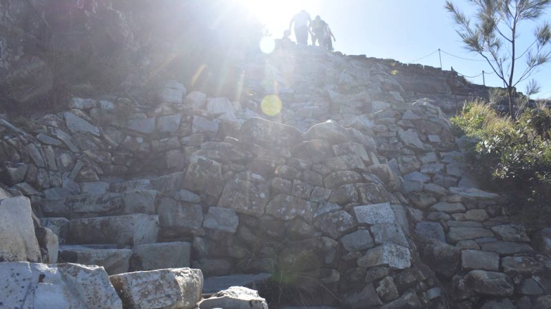
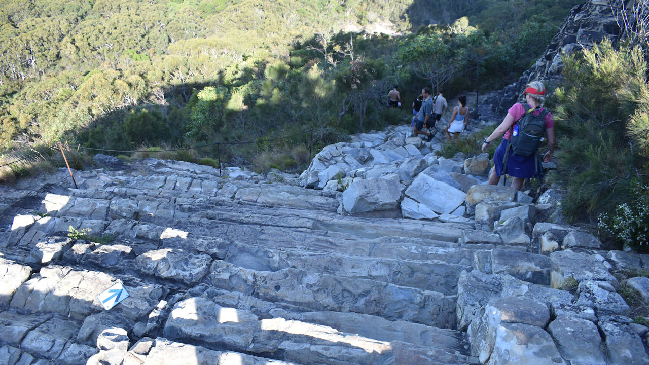
The walking trail starts off with a basic and wide dirt track that soon turns into a rock paved path. I wondered if the rock paving went all the way to the summit. In a way it does, combining either rock paving or using the natural rock steps along the way.
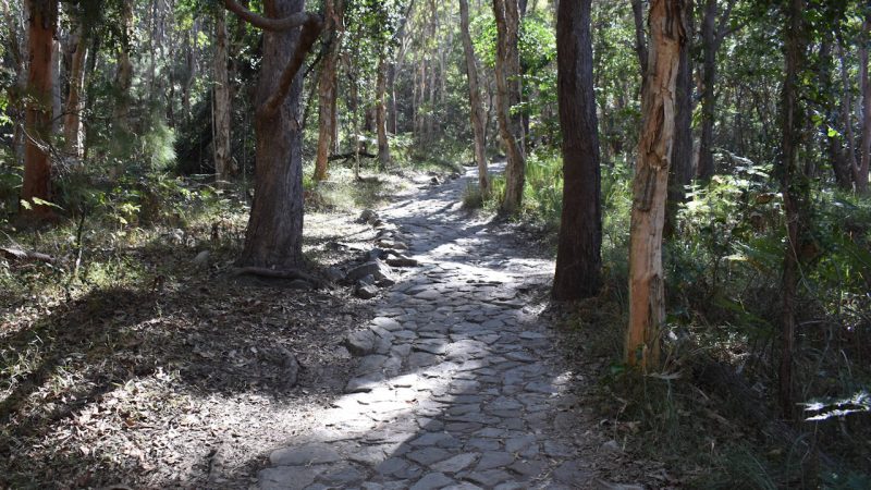
What you quickly learn is much of the rock paving is in fact rock steps, natural or otherwise. As you walk, climb, or for a very select few, run up the mountain, you realise the narrowing path also makes it difficult to pass others or let others pass you. The width of the rock steps is then widened only to enable to the path to zig and zag beside itself, almost like it can’t make up its mind to head left or right.
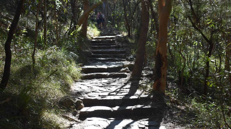
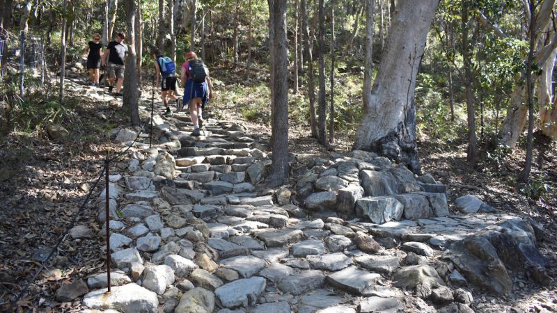
Thankfully, there are spots with some extra space to let people pass you, whether they are heading in the opposite direction or defying gravity as they seemingly meander up the mountain’s rocky climb.
Take a camera with you, it comes in handy to convincingly state “you can pass me if you want, I’m taking a photo”, as you regain some breath and give the calves a break.
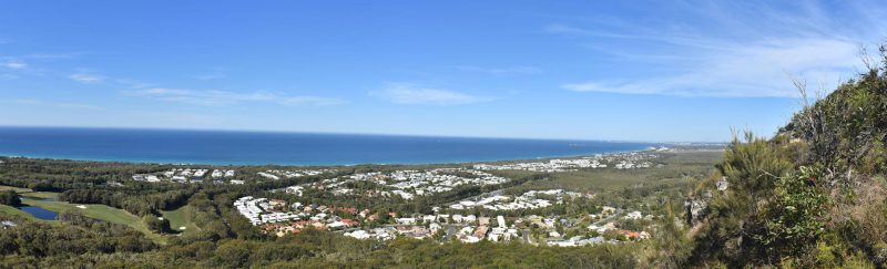
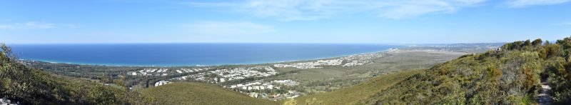
The reality is there are some great spots to take some photos. You don’t need to wait until you get to the summit to click a few pictures of some amazing views. The main feature photo was taken part way up the mountain and not the only spot you can do this from. I started hoping these were not the highlights and the true treat is when you reach the summit.
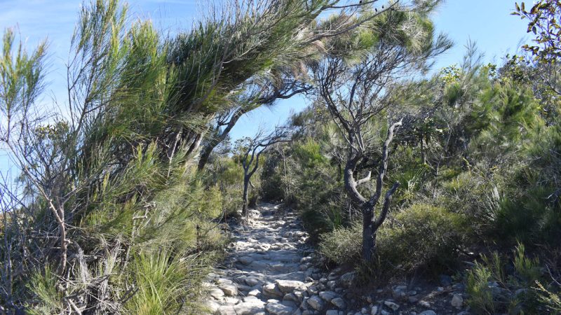
The vegetation is common scrub bushland when you start the walk but as you reach a point, the climb starts to level out and the vegetation thins out. Trees are left behind and becomes predominately lower lying montane heath plants, providing unobstructed views along the coast.
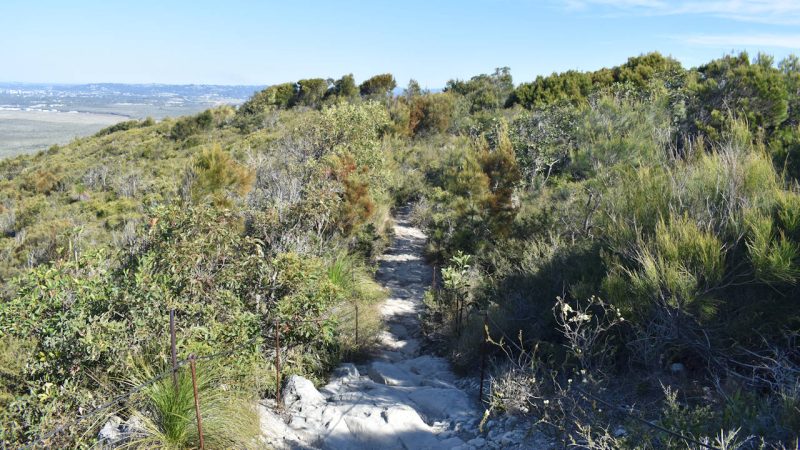
In the distance towards the left, a communication tower can be seen. The trail turns and heads in the direction of the tower and while the trail still heads upwards, it is much more gradual requiring less stops for photos (unless of course, you want to take photos).
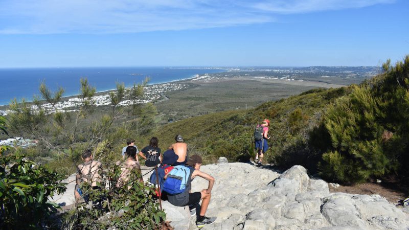
The main stage is set at the tower. It almost looks like a grandstand viewing area with stepped seating made of rock. It offers wide views out towards the coast. I was hoping for near-360-degree views, but we were not disappointed.
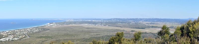
The trail continues further on to provide two more vantage points. The first is similar with a little more view to the south showing almost all of the runway of the Sunshine Coast Airport.
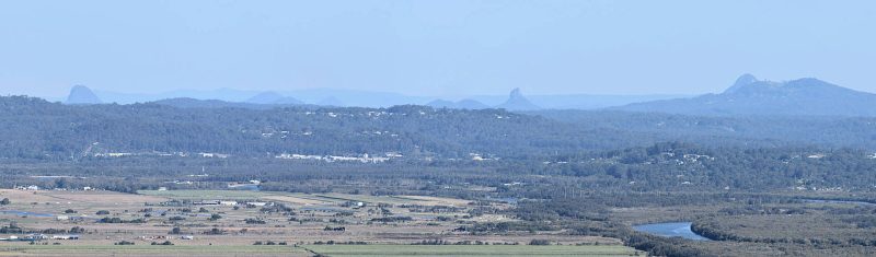
The second is only a few metres away with a more direct southern viewing vantage. Unfortunately, it is more obscured but does give views of the Glasshouse Mountains and the Maroochy River that heads behind the western side of the mountain.
Closer Mount Ninderry ![]()
![]() is further to the right, which also has a walking trail.
is further to the right, which also has a walking trail.
Mount Coolum
The mountain was formed millions of years ago as a bubble of molten magma into the surrounding sandstone. The bubble is called a laccolith, a large dome-shaped chamber filled with the magma. The magma cooled forming rhyolite rock, slowly revealed as the surrounding sandstone eroded away around it.
What is left is the 208-metre-high dome of rock. Distinctive hexagonal-shaped columns can be seen on the way up, particularly at the point where the main ascent finishes (and gives false hope you are close to the top). They are similar to the columns of the Fingal Causeway at Fingal Beach Headland ![]()
![]() , only they are horizontal instead of vertical.
, only they are horizontal instead of vertical.
The name Coolum appears to be derived from the Aboriginal word gulum or kulum, meaning blunt or headless. Presumably this is a reference to the shape of Mount Coolum having no defined peak. The Aboriginal story tells of Mudjimba is the head of Coolum, falling into the ocean after it was knocked off by Ninderry.