


We conducted Dularcha To Ewen Maddock Circuit in two stages, the first visiting the Dularcha National Park and later riding the Dularcha To Ewen Maddock Circuit the signs are there for, as a guide to navigate parts of the circuit.
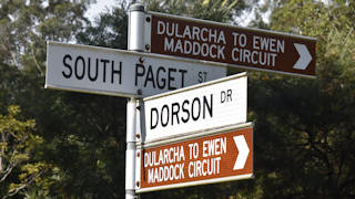
Our first visit started from Mooloolah Valley, parking near the Dularcha National Park entrance on South Paget Street (accessed via Dorson Drive). There is a small parking area for a few cars and a sheltered hut over an information board. There are no other facilities including no toilets so prepare before you get there.
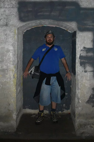
One of the key attractions is the Dularcha Tunnel, a disused railway tunnel officially opened in 1891. It was used for over 40 years until the railway line was relocated in 1932. We came prepared with torches to walk through the dark tunnel.
The concrete-lined tunnel is one of only two tunnels built along the North Coast Line between Brisbane and Gympie. If you know where the other is, send us a message as is seems a mystery where it is.
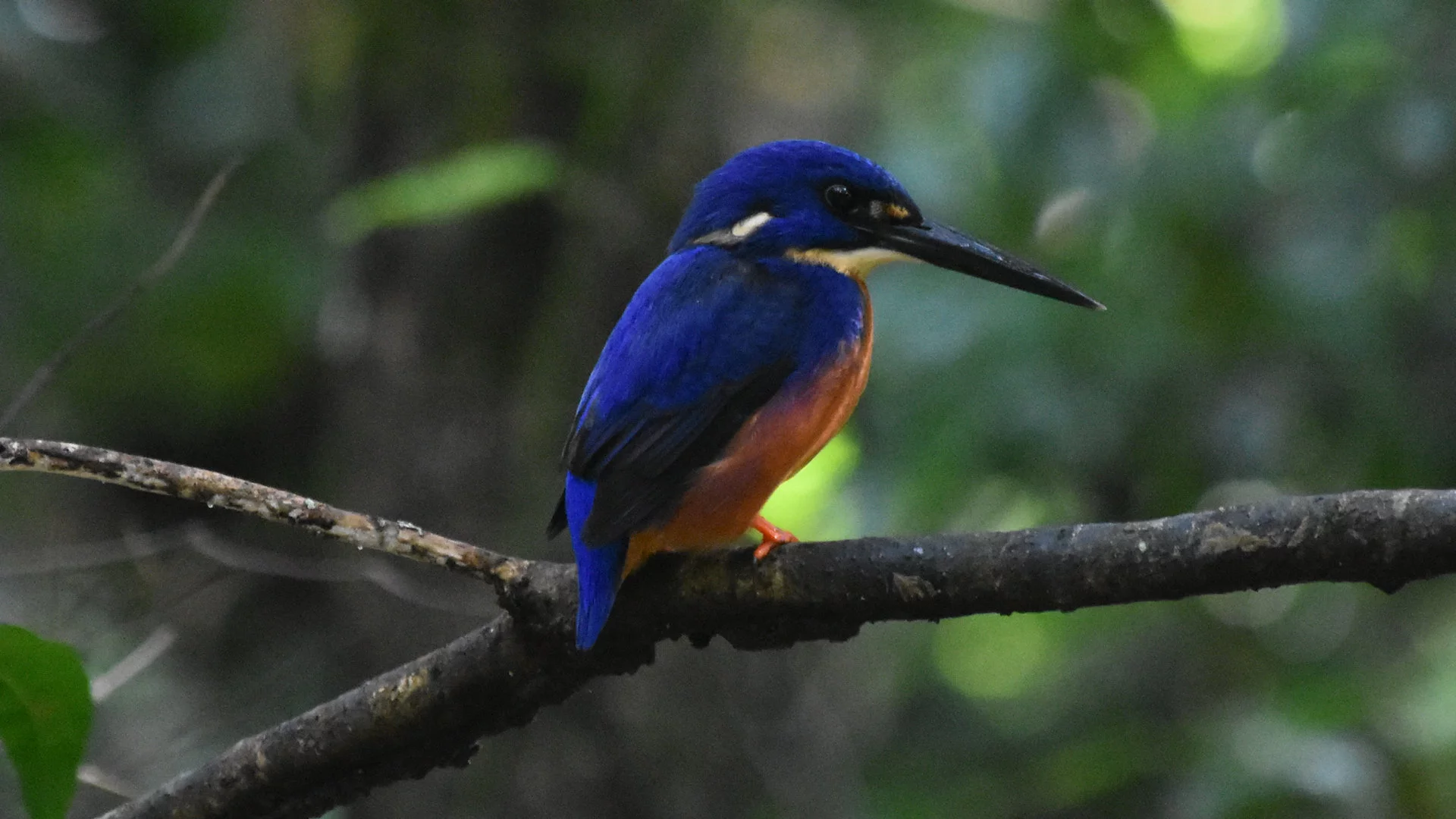
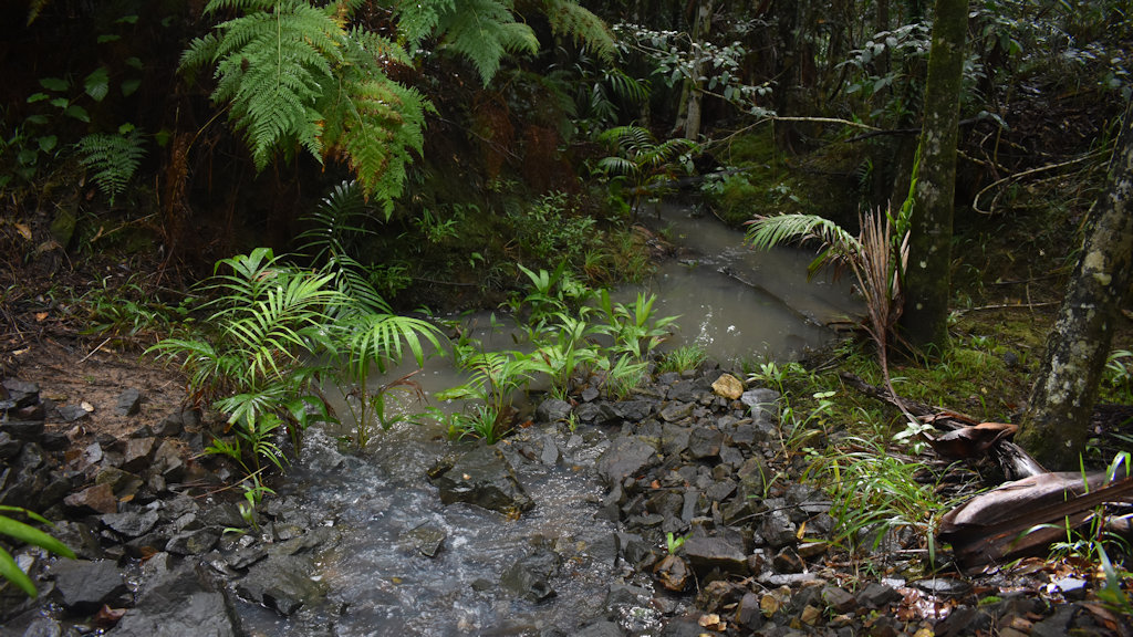
We barely took two steps into the walking trail when we spotted a beautiful Azure Kingfisher. There is a small creek that flows across the trail and it was hunting for food just to the right of the track.
Tunnel Track
The trail heads uphill but being a disused railway line, it isn’t particularly steep. If you mainly want to see the tunnel, this is a good approach as it is only 900 metres. The ground is unsealed and uneven in spots but it is mostly flat making it an easy walk for almost everyone.
You can also walk from the other end which has more parking available but is a longer walk, around 2.5km one-way. It follows the disused railway line part of the way, some parts are more hilly but still easy enough.
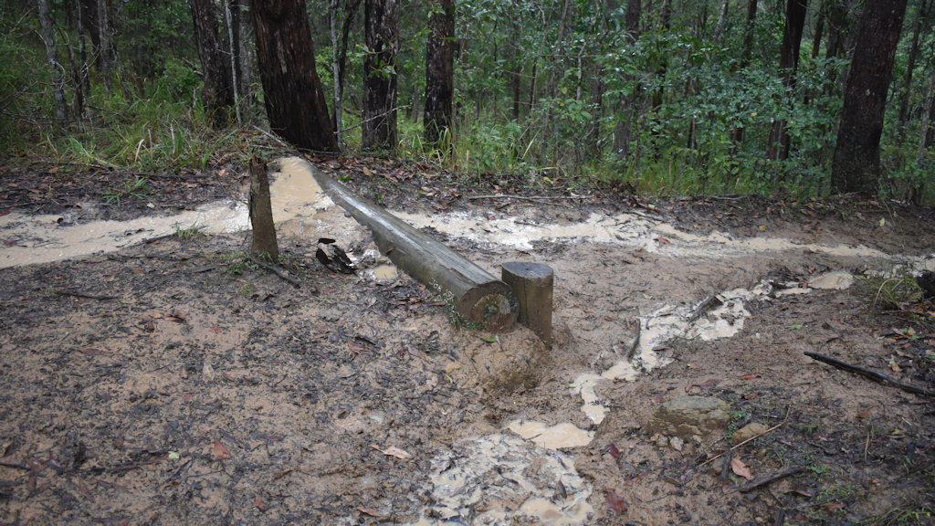
The trickiest part of the trail was that it had been raining so the track was wet and still holding water puddles which took some dancing to avoid some of sock-wetting parts.
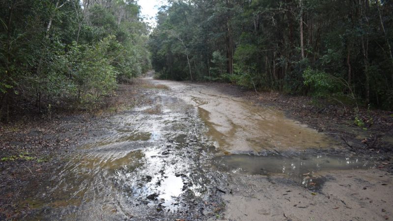
Horse riding is permitted at Dularcha National Park as well, so the wet sections can be stirred up a bit by hooves. Overall, the track is easy to get along over.
On reaching the entrance of the tunnel, you have an option to use a bypass track. I believe this is so horses can get passed the tunnel if they are skittish in enclosed spaces but it can equally be useful for people as well.
The tunnel is meant to have bats that live inside, a reason some may choose to use the bypass track. The two times we have been there we didn’t see any bats or any sign of them being there, unlike Boolboonda Tunnel ![]()
![]() which had many bats on the tunnel walls and ceiling. Muntapa Tunnel
which had many bats on the tunnel walls and ceiling. Muntapa Tunnel ![]()
![]() also had bats but you can’t access the tunnel far enough to see them but you can certainly smell them.
also had bats but you can’t access the tunnel far enough to see them but you can certainly smell them.
The tunnel entrance appears which at first looks as though it leads into the darkness underground. As you get closer, you can see the tunnel bends towards the left but you can see a faint glow of light around the corner.
You could walk through the tunnel without a torch if you give yourself time to adjust to the low light, especially during the middle of the day when there is more light, however, a torch will certainly make it easier.
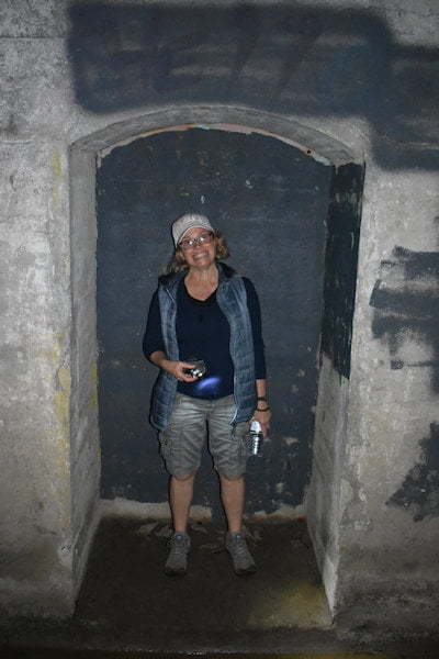
There are a couple of safety bays recessed into the walls part way through the tunnel. Wide enough for two people to stand in, these bays are located about 1/3 of the way in from each end to seek refuge if anyone are caught in the tunnel when a train comes through it.
The tunnel received listing in the Queensland Heritage Register in 1999 for its importance in Queensland’s history.
You can continue walking beyond the tunnel to the parkland and parking area at the Landsborough end. From there, you can continue walking to Landsborough township and catch the train back to Mooloolah train station.
Roses Circuit
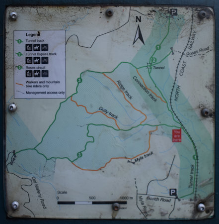
We chose to walk the Roses Circuit loop instead, heading in a clockwise direction. We continued along the old railway line until we reached the junction for the Roses Circuit track, about 1 kilometre passed the tunnel.
Roses Circuit is a harder trail to walk and is a lot further at around 8 kilometres. It starts off easy enough but is narrower and a little hillier as it doesn’t follow an old railway line – no easy grades for locomotives.
There are tracks that lead off the sides which can be used by walkers and bike riders, however, horse riders must stay on the main Roses Circuit track. We didn’t go on any of the side tracks but we would consider Myla Track next time we go.
The track heads west and is generally level with the odd exceptions such as when reaching a small creek to cross. The wet weather had the positive effect of having running water in the creeks that may have otherwise been still or dry.
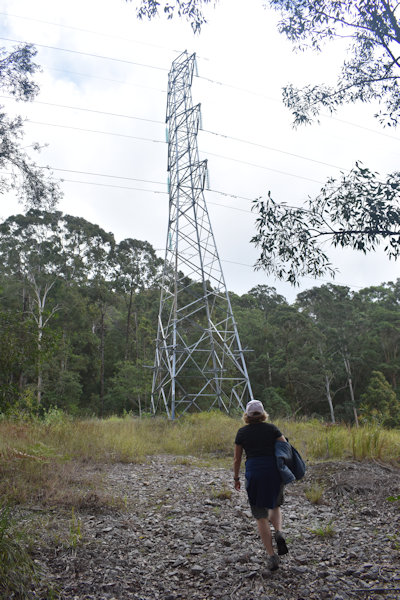
The side tracks are signposted clearly enough but there is a junction following Roses Circuit that isn’t clearly marked. The trail starts to go uphill with a track off to the left. Straight ahead you can see powerlines and a powerline tower. Take the track to the left as you will be returning down the hill after you realise there is nowhere else to go once you get to the tower. It is basically there to access the tower.
The trail becomes quite steep here and we had to stop frequently to get our breath again. It is this section that the Myla side track may be a good alternative route to avoid this steep section. That being said, we haven’t used the Myla Track so it could be steep also.
Once getting to the top of the climb the track flattens out for a while and heads north. The trail has a few up and down sections, some of them steep. The steepness was enough that keeping your feet underneath you was tricky in spots and needed care to prevent sliding too much.
Our good luck with the weather started to run out. It didn’t just rain, it poured. This because quite challenging as the ground was still steep but now muddy and slippery. It slowed out progress and it took us much longer to complete the circuit then we estimated it would have. The steep hills alone slowed us down, the wet weather made it moreso.
The first half of Roses Circuit, as well as the main Tunnel Track, avoiding walking in mud wasn’t too difficult. The downhill part of the circuit approaching the tunnel was much trickier and some parts trampling in some mud was unavoidable.
Would we do the long circuit again? Yes, we want to go back and do it again. The downhill part we spent a lot of time concentrating on getting down the slippery wet trail that we didn’t have the luxury to observe and enjoy it as much as we would have liked. We have been back for the full Dularcha to Ewen Maddock Circuit for a bike ride but not around Roses Track.
I wouldn’t consider riding a bike around Roses Circuit Track, I don’t know how horses would go on it either with parts being so steep. We saw a few horses along the railway track but none using Roses Circuit. They do use it though, evident with many hoof prints around the muddy sections.
To get there:
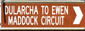
From Glass House Mountains Visitor Information Centre, head to Steve Irwin Way and turn left. Follow Steve Irwin Way for 16.1km and turn left into Mooloolah Connection Rd towards Mooloolah Valley. Follow Mooloolah Connection Rd for 6.8km into the township of Mooloolah, crossing over the railway line. Continue straight ahead for 300m and turn left into King Rd at the brown sign for Dularcha To Ewen Maddock Circuit. Follow King Rd for 500m taking the first left into Dorson Dr at another brown sign. Follow Dorson Dr to the end and turn right at another brown sign at South Paget St. The parking area is just ahead with the walking entrance into Dularcha National Park.
If on the Bruce Hwy, take exit 188 onto Steve Irwin Way towards Landsborough and Tourist Drive 24. Follow Steve Irwin Way for about 3km and turn right into Mooloolah Connection Rd towards Mooloolah Valley. Follow Mooloolah Connection Rd for 6.8km into the township of Mooloolah, crossing over the railway line. Continue straight ahead for 300m and turn left into King Rd at the brown sign for Dularcha To Ewen Maddock Circuit. Follow King Rd for 500m taking the first left into Dorson Dr at another brown sign. Follow Dorson Dr to the end and turn right at another brown sign at South Paget St. The parking area is just ahead with the walking entrance into Dularcha National Park.
If heading north on the Bruce Hwy, you can exit earlier onto Steve Irwin Way at exit 163 as an alternative. Follow Steve Irwin Way for 11km to Glass House Mountains where the Information Centre is, then follow the directions above from the Visitor Information Centre.

