Mt Scoria Conservation Park

View of Mount Scoria

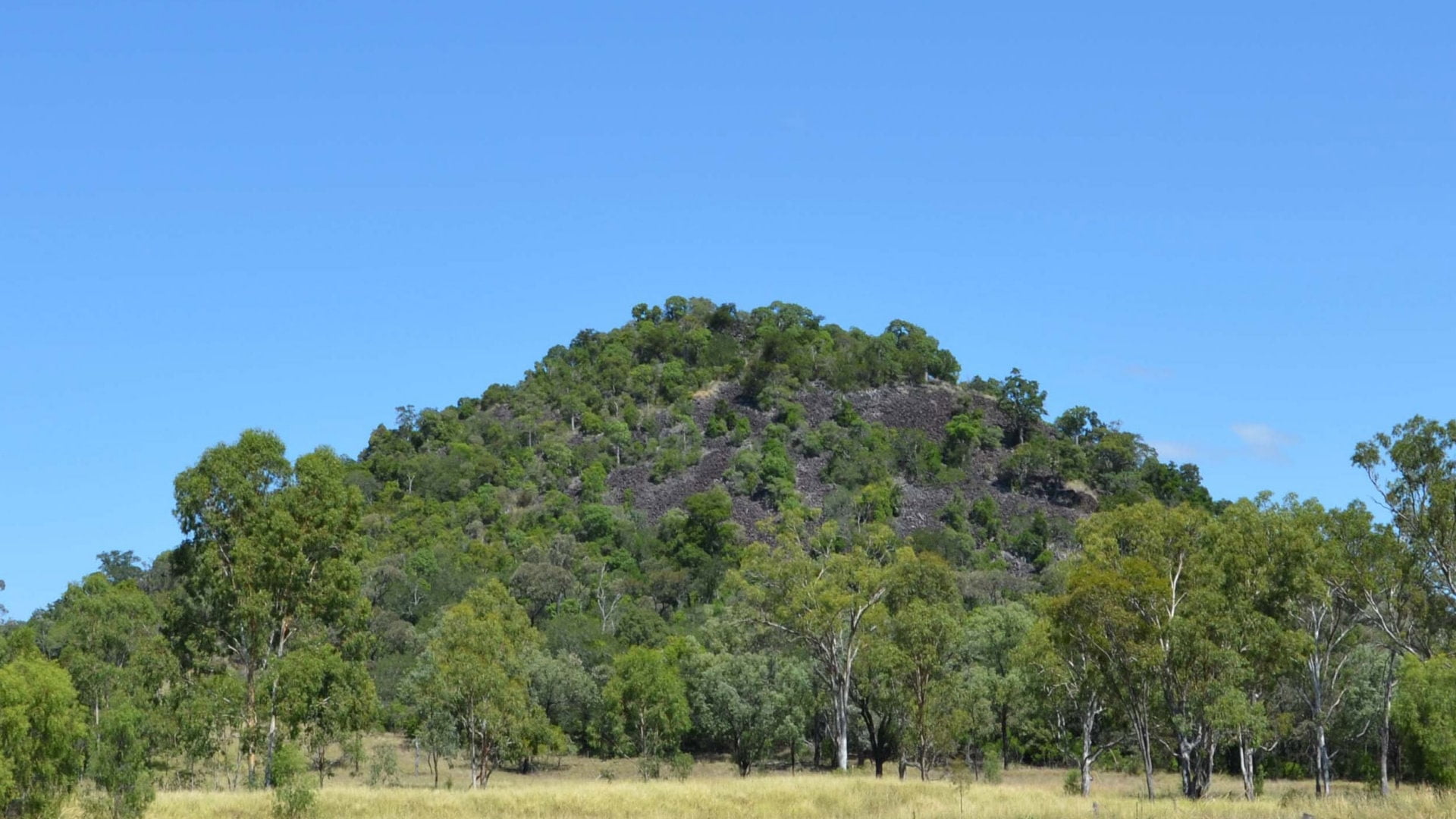
Mount Scoria is a mountain that was a basalt plug of a small volcano. The cooling process created angular columns with between five to eight sides. The shapes started as cracks in a similar fashion cracks form in dry mud. The cracks grew deeper as the lava below cooled to form the columns. Mount Scoria is known … Read more

Kroombit Tops National Park

View from The Lookout at Kroombit Tops looking over the Boyne Valley. Kroombit Tops National Park north of Cania Gorge

Kroombit Tops is a national park in a rugged area north of Monto and Cania Gorge National Park, south-west of Gladstone and east of Biloela. The park is accessible to conventional vehicles however to see the whole park a high clearance 4wd is recommended. There are three entrances to Kroombit Tops National Park. Conventional vehicles … Read more

Kirar Weir

Weir from the bottom with no flow of water. Kirar Weir is west of Eidsvold on the Burnett River and a day use area with a toilet, picnic tables, and wood BBQ

Kirar Weir is on the Burnett River eight kilometres from Eidsvold. The weir was built in 2005 with the name Kirar given by the local aboriginal group Wakka Wakka meaning ‘creek’. The park is next to the weir to enjoy the area and has toilets with flushing toilets, a sheltered and an unsheltered picnic table, wood BBQ, … Read more

Lake Baroon (Northern Area)

Lake Baroon is between Maleny and Montville on the Blackall Range. The lake is created from the Baroon Pocket Dam  on the Obi Obi Creek, as a water supply for the Sunshine Coast area. This is the northern recreational area for Lake Baroon and accessed from Montville. Another recreational area is on the southern end … Read more

Baroon Pocket Dam

Baroon Pocket Dam is near Montville, built on Obi Obi Creek, and forming Lake Baroon . The ungated dam was completed in 1989 and is used for potable water supply. A plaque shows it was officially opened in July 1989. The main inflows are from Bridge Creek and Obi Obi Creek, and the dam spillway … Read more

Gardners Falls

Gardners Falls is a popular spot near Maleny along the Obi Obi Creek. The easy 800m return walk leads to a swimming hole above and below the main falls. Swinging ropes are positioned around the hole, and the rock ledges at the top of the falls provide additional launching points for the adventurous. Jumping into … Read more

Pental Island

Pental Island is an inland island bound by the Murray River and the anabranch Little Murray River. Little Murray River is on the southern side of the island, with the New South Wales and Victoria border along the Murray River on the north side, making Pental Island part of Victoria. An anabranch is when a … Read more

Hinze Dam

Hinze Dam is the Gold Coast’s main water supply for drinking water. The dam is ungated, which means the dam fills to capacity, then spills out over the spillway. Named after the Hinze family who first farmed the area, the dam was first completed in 1976, and then upgraded in 1989 to nearly 4 times … Read more

North Pine Dam McGavin View

McGavin View is a picnic and viewing area of North Pine Dam on Lake Samsonvale, just west of Petrie. It is the closest area to the dam wall, with Bullocky Rest  visible across the other side. Forgan Cove is further south, but there are no views of the dam wall from there. The park is … Read more